FROM GARFIELD COUNTY EMERGENCY MANAGEMENT-THURSDAY, JUNE 15, 2017
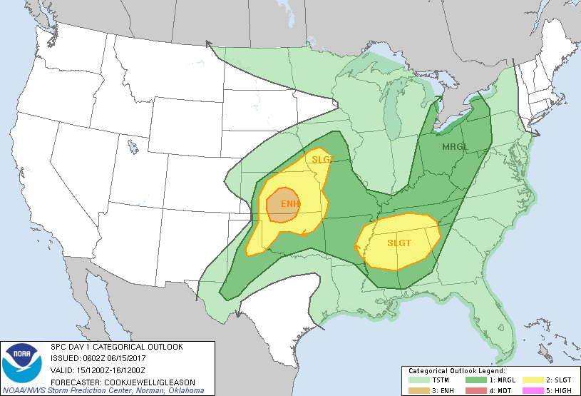
Today looks interesting. Do you need to panic? NO. You need to make sure you have an area to park your car, truck, bike or whatever where large hail won’t damage them. That could have been the case yesterday but as you can see in the first graph below; we are in an ENHANCED RISK AREA for severe weather later today. Look at the graph for the risks and don’t get fixated on where lines are on a map. That said, “if” storms do affect us, and today looks pretty good for that, these storms will be slow movers and they will create very heavy rainfall along with winds and hail. Just make sure things are secure around the house, at work, or wherever you are and we should be ok. I will do live broadcasts this afternoon on Facebook at least if needed for updates.
If storms occur, listen to our LOCAL RADIO stations as we coordinate with them and other media sources. I would highly advise for those that haven’t, to download our emergency App GARFIELD COUNTY EM. This way you will be kept up to date with what’s going on. NWS WARNINGS automatically come through our app.
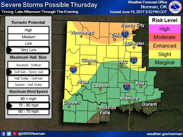
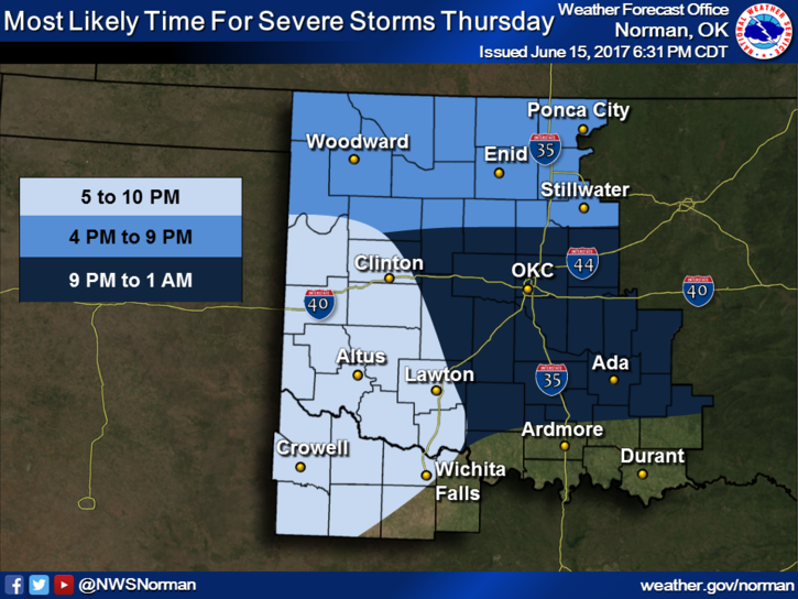
Here is your forecast from the NWS/NORMAN;
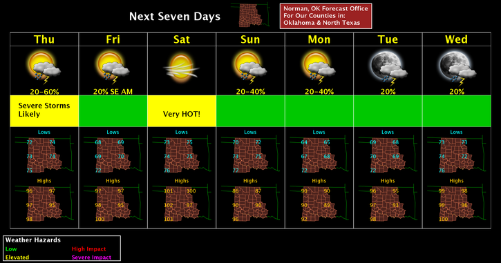
Thursday-A slight chance of showers and thunderstorms before 7am, then a chance of showers and thunderstorms after 4pm. Some of the storms could be severe. Mostly sunny and hot, with a high near 97. Heat index values as high as 102. South wind 7 to 17 mph, with gusts as high as 24 mph. Chance of precipitation is 30%.
Thursday Night-50 percent chance of showers and thunderstorms before 1am. Some of the storms could be severe. Increasing clouds, with a low around 69. East southeast wind 9 to 18 mph, with gusts as high as 25 mph. New rainfall amounts between a half and three quarters of an inch possible.
HAVE A SUPER DAY!!
MIKE