FROM GARFIELD COUNTY EMERGENCY MANAGEMENT-WEDNESDAY, JUNE 14, 2017
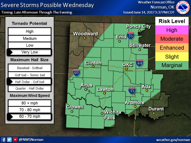
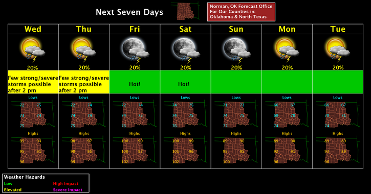
After reading all the guidance this morning, it may be interesting this afternoon. We are in a MARGINAL RISK for t-storms later today but it wouldn’t surprise me if we end up in a slight risk area. That said, there will be a trough that runs roughly from Wichita, Ks. through Enid down to Lawton. This “may” be the focal point for storms this afternoon. The second graph below will show you what to expect if storms form in the area. PANIC is not necessary at this time. We’ll see what happens.
Tomorrow, we’ll be in a slight risk area so just be prepared for some bumpy weather. We’ll be ok. Hopefully we will see some rainfall to knock down some of the dust and dirt in the air.
IF you see smoke or fire out there, call 911 immediately and give the best directions possible. If wheat is on fire, that’s someone’s livelihood.
Remember to download our GARFIELD COUNTY EM app.
Here is your forecast;
TODAY: Slight chance for showers before 7am then a 30% chance for storms after 4pm this afternoon. Highs around 95 with a heat index of 98. SW winds 15-25 mph.
TONIGHT: 20% chance for storms before 1am. Lows around 74 with south winds 5-15 mph.
HAVE A GREAT DAY!!
MIKE