0407L-THURSDAY OUTLOOK FROM GARFIELD COUNTY EMERGENCY MANAGEMENT-6/23/22
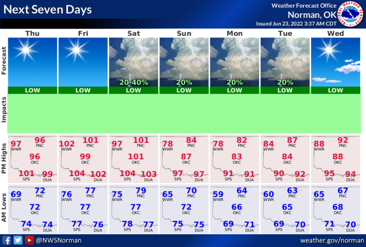
1- A few more HOT days then we cool off a little. The front that affected the area yesterday will wash out today and no thunderstorms are expected later this afternoon. Just the heat, This weekend, we will have a stronger cold front push in giving us a chance for more rain but we can ALSO expect cooler air. We expect this front Saturday night into Sunday morning and high temps after frontal passage should range from the upper 70s to upper 80s Sunday through Wednesday. We’ll see what happens.
2- Overall, we’ll be ok so here is your forecast from the NWS/NORMAN;
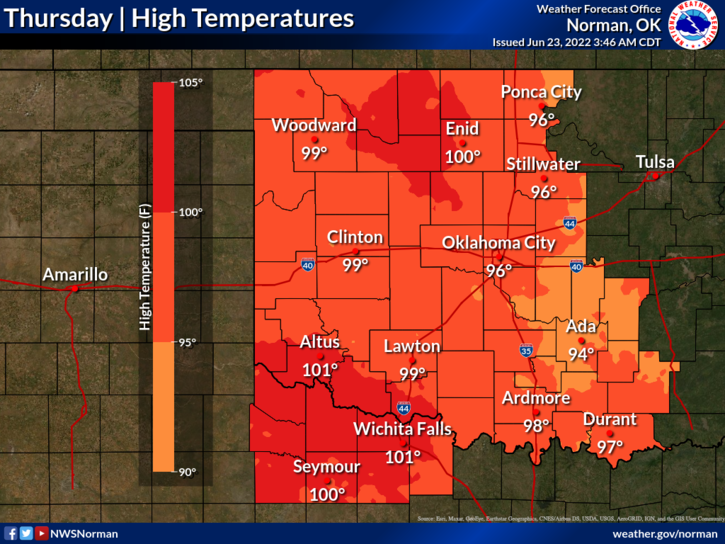
Today-Sunny. Highs in the upper 90s. South winds 10 to 15 mph.
Tonight-Mostly clear. Lows in the upper 70s. Southeast winds 10 to 15 mph with gusts up to 25 mph.
HAVE A GOOD DAY!