0322L-WEDNESDAY OUTLOOK FROM GARFIELD COUNTY EMERGENCY MANAGEMENT- 6/22/22
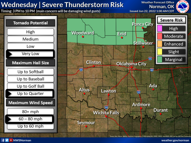
1- MARGINAL RISK FOR SEVERE WEATHER LATER THIS AFTERNOON & EVENING. TIMING IS ROUGHLY FROM 3 UNTIL 10 PM. If storms occur, damaging wind gusts 60-80 mph along with some quarter size hail are possible. Per SPC guidance, storms should initiate in Southwest Kansas and NW Oklahoma and slowly move eastward. Where that line actually may be will be known when storms form. Most likely in the MARGINAL RISK AREA.
We’ll keep an eye out and advise over our GARFIELD COUNTY EM app. If you haven’t downloaded it yet, do so. You never know when you’ll need it and it’s loaded with preparedness information.
2- Here is your forecast from the NWS/NORMAN;
Wednesday-Mostly sunny. A slight chance of showers and thunderstorms in the afternoon. Highs in the mid-90s. North winds 5 to 10 mph. Chance of rain 20 percent.
Wednesday Night-Mostly cloudy in the evening, then becoming partly cloudy. Humid with lows in the lower 70s. East winds 5 to 10 mph.
STAY COOL AND HAVE A GOOD DAY.