0400L-THURSDAY OUTLOOK & INFO FROM GARFIELD COUNTY EMERGENCY MGMT-6/4/2020
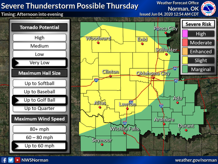
1- We are in SLIGHT RISK AREA FOR SEVERE WEATHER later today into the evening hours. A front, dryline and a lot of instability and heat will help initiate storms later this afternoon. If storms do occur here, expect winds to 60+ mph, possibly golf ball size hail and very heavy rainfall. We’ll see what happens. Make sure you have our GARFIELD COUNTY EM app so you can stay advised from us and the NWS.
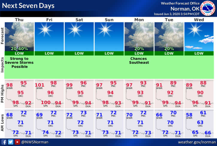
2- After today’s threat, Friday through the weekend looks good then rain chances return on Monday and Tuesday. Again, we’ll see what happens. Here is your forecast from the NWS/NORMAN;
Today-Partly cloudy. 50% chance of thunderstorms late in the afternoon. Highs around 100 with South winds 10 to 15 mph.
Tonight-Mostly clear. 30% chance of thunderstorms in the evening. Lows around 70. South winds 10 to 15 mph.
HAVE A SUPER DAY AND STAY COOL!
MIKE