0425L-WEDNESDAY OUTLOOK & INFO FROM GARFIELD COUNTY. EMERGENCY MANAGEMENT-6/3/2020
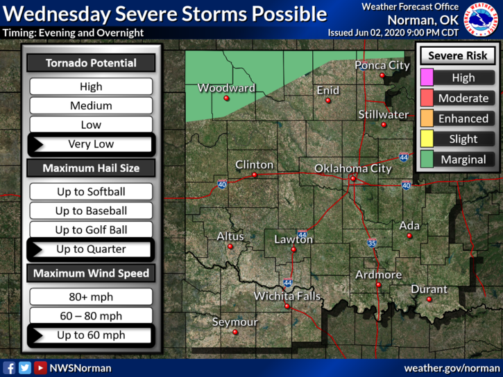
1- TOASTY temps are forecast today as we look to be in the upper 90’s. There is a low chance we could see thunderstorms late tonight into the early morning hours. We are in a GENERAL THUNDERSTORM RISK area mainly for tonight. If storms occur, they would be drifting in from northwestern Kansas. Heavy rainfall and damaging winds of 60+ mph are the main issues along with some hail. We’ll watch this closely and advise as needed.
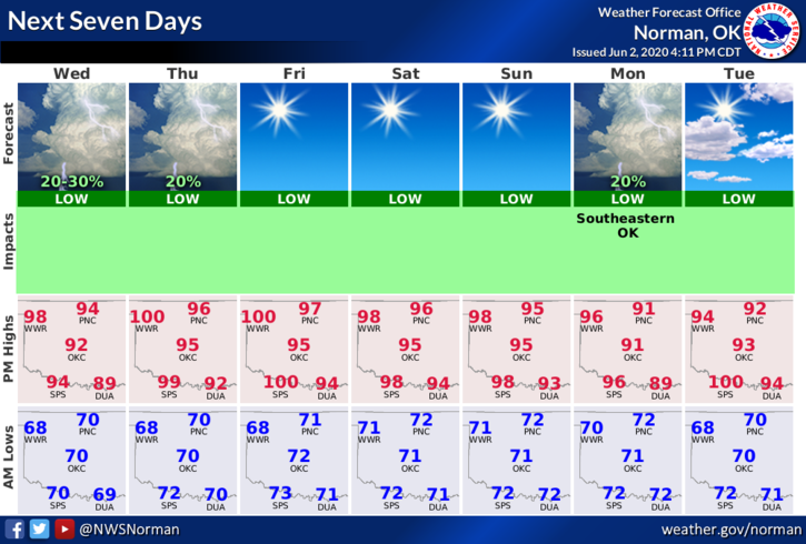
2- The above said, here is your forecast from the NWS/NORMAN;
Wednesday- Sunny and hot with a high near 97. South-southwest winds 10 to 15 mph.
Wednesday Night-Partly cloudy with a low around 71. South winds 5 to 10 mph.
DIRECTORS COMMENT
I try to stay away from political and social unrest issues but this morning I want to state an advisory to many out there. Social media has a lot of untrue information and many folks are putting that false info out there on their pages. INVESTIGATE ANYTHING where your emotions get involved BEFORE you re-post it. Here’s why, during severe weather for instance, I have stated that the TV media gets your emotions going by using the drama of the situation. I have stated that you can’t make good decisions when you get emotional. Think about this. When someone posts that something will happen in wherever, Oklahoma, investigate it first before re-posting or you end up being a part of the problem of posting bad information. No one needs that added stress. MY WORDS FOR TODAY ARE: CALM DOWN, INVESTIGATE, AND THEN POST.
HAVE A GOOD DAY!
MIKE