0355L-THURSDAY OUTLOOK FROM GARFIELD COUNTY EMERGENCY MANAGEMENT-6/6/19
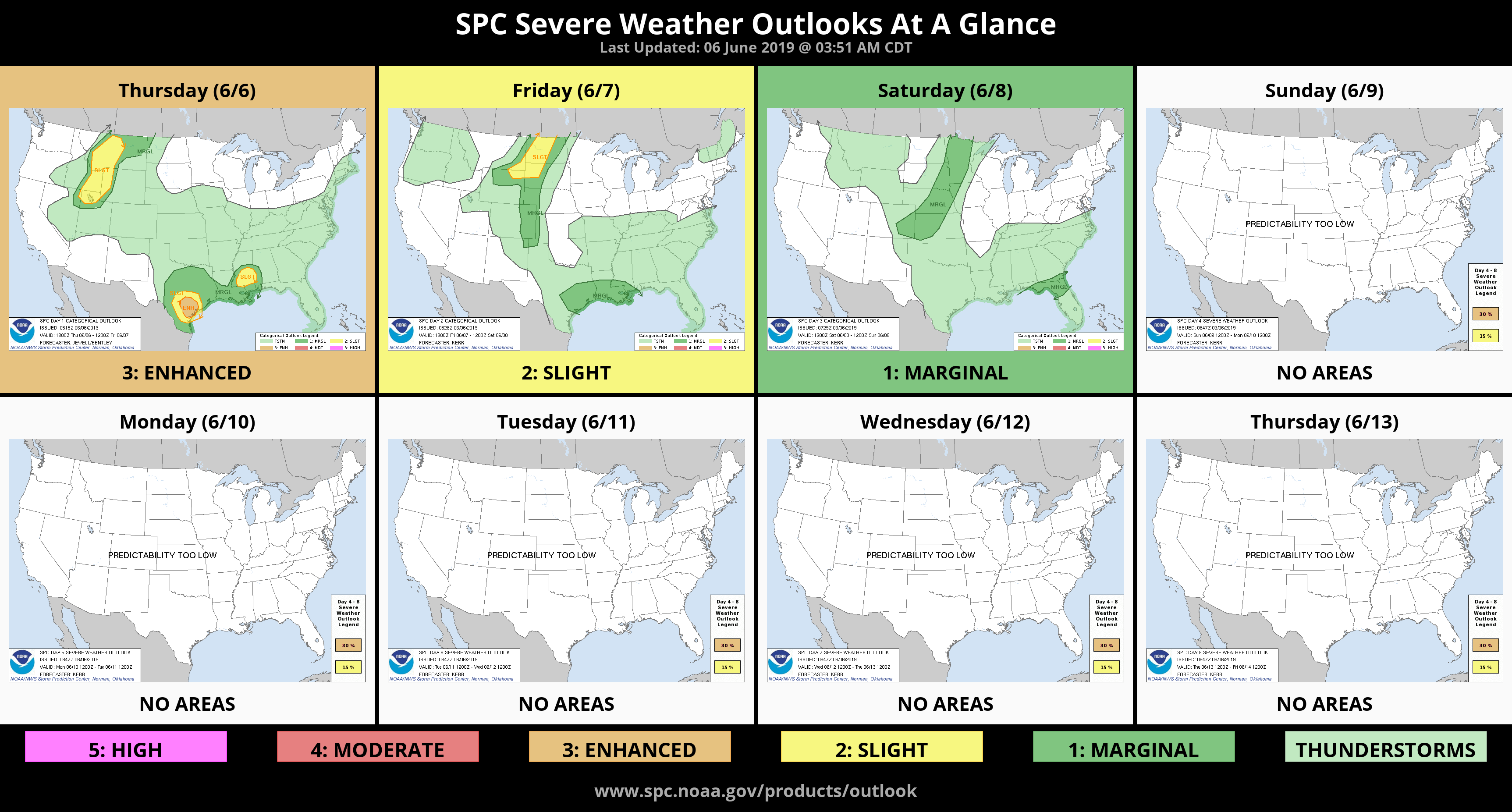
1- GENERAL thunderstorm risk today. The main issue will be torrential rainfall and gusty winds.
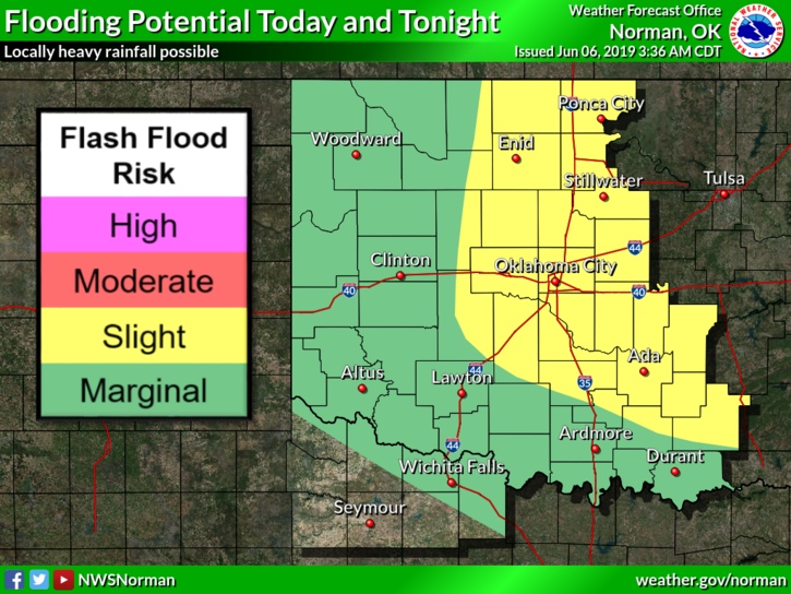
2- FLOOD WATCH in effect through Friday morning. We are expecting heavy rainfall in the area that could cause flash flooding issues. Use EXTREME CAUTION while driving if heavy rainfall is occurring.
3- BARRICADES- if these are up in any area around the region, DO NOT DRIVE AROUND THEM! They are up to help you make good decisions. Driving around them is a bad one.
4- GARFIELD COUNTY EM- Our notification app. NWS WARNINGS/SIGNIFICANT ADVISORIES automatically push through along with LOCAL important information from your LOCAL E.M. OFFICE.
5- Here is your forecast from the NWS/NORMAN;
Today-Mostly cloudy with thunderstorms likely. Highs in the lower 80s. Light and variable winds. Chance of thunderstorms 70 percent.
Tonight- 40% chance of thunderstorms in the evening and overnight with lows in the lower 60s. Winds will be light and variable.
HAVE A GOOD DAY!!
MIKE