0405L-THURSDAY OUTLOOK FROM GARFIELD COUNTY EMERGENCY MANAGEMENT-3/11/21
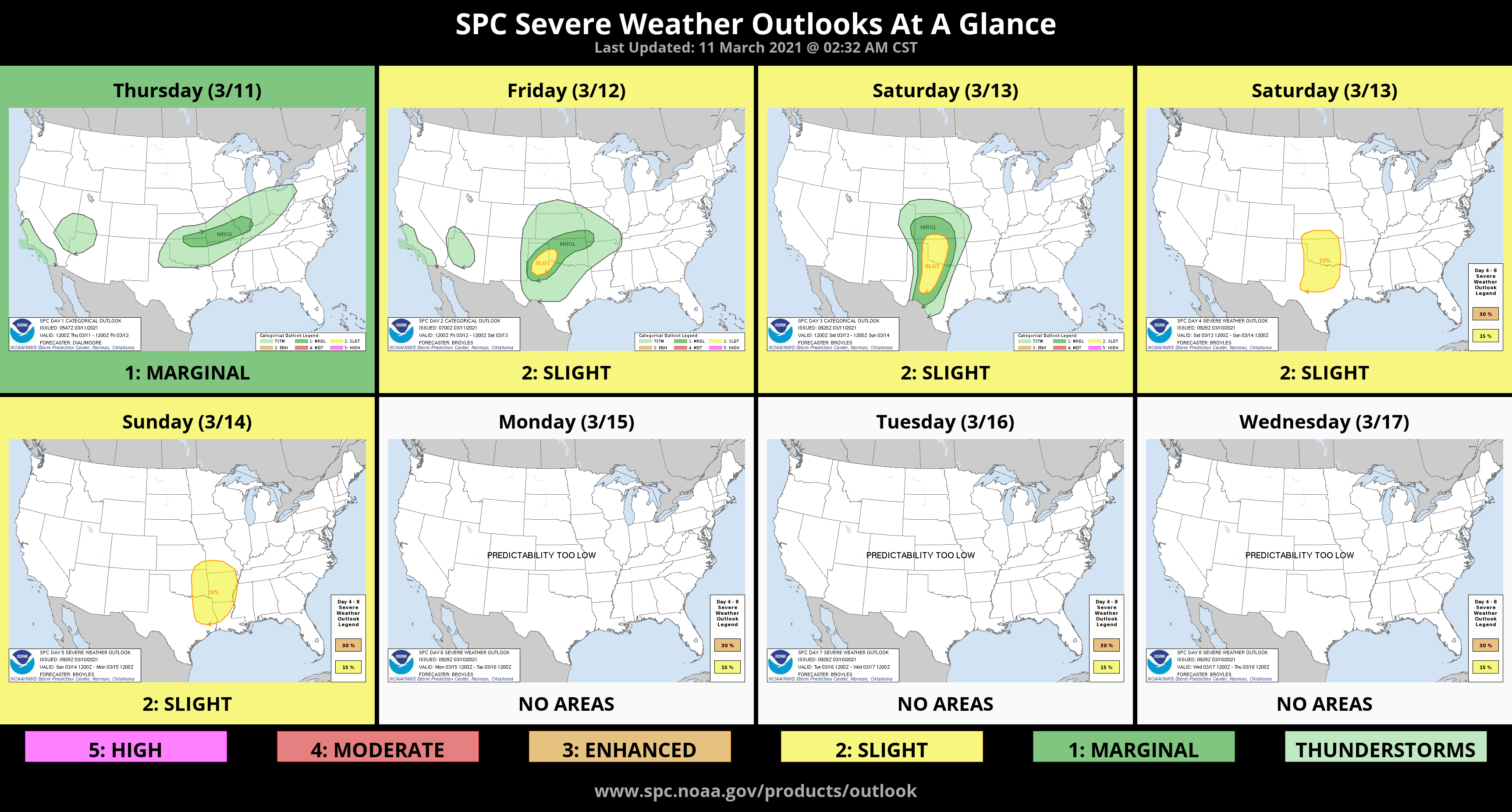
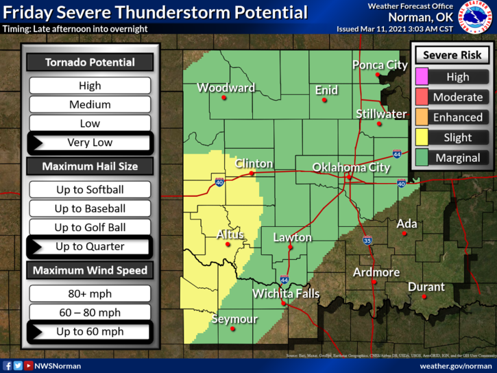
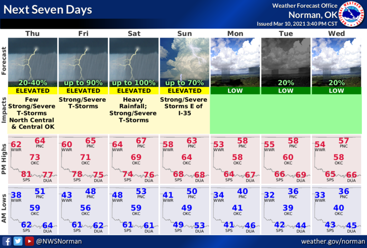
1- We are in a MARGINAL risk for possibly some severe weather later tonight. A front pushed through overnight and will stall out somewhere south of us and will push back to the north later tonight. Where the front actually ends up in the area is still in question so, if it stalls over us, we could see some heavy rainfall as other systems push through the area. Over the course of the next few days, this will put us in a slight risk or higher for severe weather with hail and winds being the main threats. We will watch this closely between now and over the weekend. Welcome to spring-like weather.
2-If you watch television weather, get ready for the doom and gloom shows and all the drama that comes with it. Too bad they scare folks for ratings. If they taught folks what was really going on, we would actually have a smarter society. Don’t fall for the hype! Stay calm and make sure you have our GARFIELD COUNTY EM app. You will get advisories and warnings directly from the NATIONAL WEATHER SERVICE in Norman and other local info from us at GCEM. Remember to listen to your LOCAL FM Radio stations here in the area during rough weather. We’re in this for PUBLIC SAFETY, not PUBLIC PANIC.
3- Here is your forecast from the NWS/NORMAN;
Today-Cloudy, with a high near 56. North northeast wind 10 to 16 mph, with gusts as high as 23 mph.
Tonight-30 percent chance of showers and thunderstorms after 3am. Mostly cloudy, with a low around 47. Northeast wind around 9 mph.
I’ll advise as needed.
Mike