0405L-WEDNESDAY OUTLOOK FROM GARFIELD COUNTY EMERGENCY MANAGEMENT-3/10/21
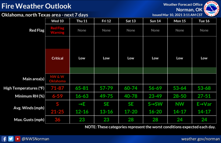
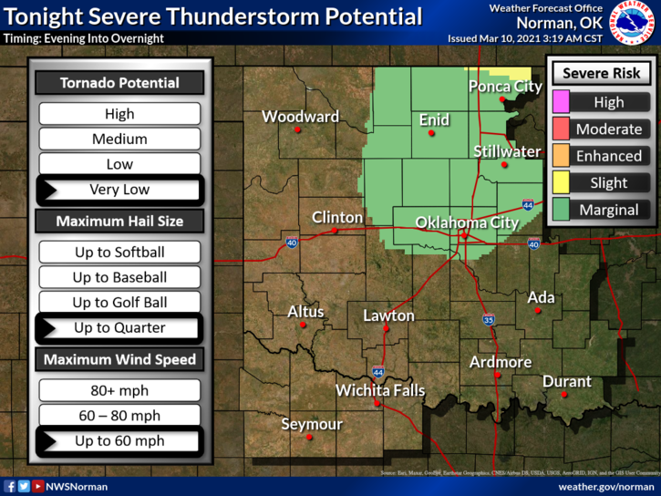
1- MARGINAL TO SLIGHT RISK FOR SEVERE WEATHER starting later tonight through the weekend. RED FLAG FIRE WARNING from 11am until 9pm tonight. It’s going to be an interesting day, evening, and rest of the week.
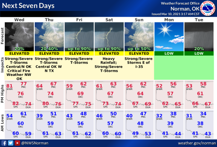
2- WEATHER-WISE- chance for severe weather later tonight as a dryline possibly moving through the area. Models are not in agreement for this so just be prepared for possibly a little noise later tonight. This will be the norm through the weekend. I will advise via video on social media if needed. A cold front will push into the area Thursday morning and stall out somewhere between 1-40 and the Kansas/Oklahoma line. This may bring us an opportunity for flooding rainfall depending where exactly this sets up. KEEP THIS IN MIND- DO NOT DRIVE THROUGH fast flowing water in low lying areas. We do have SWIFT WATER RESCUE TEAMS but you REALLY don’t need to test their skills.
3- FIRE-WISE- RED FLAG WARNING in effect will bring strong winds along with gusts to 40 mph along with low humidity and dew point temps. NO OUTDOOR BURNING TODAY PLEASE. If you see smoke and or fire, call 911 immediately.
4- Finally, we had a winter, now it appears we may have an active spring. Hang on tight and we’ll get through it. The best thing for you all is download our GARFIELD COUNTY EM app. Learn it, read it and understand it. It just might save your life.
5- Here is your forecast from the NWS/NORMAN;
Wednesday-Mostly sunny, with a high near 79. Windy, with a south southwest wind 20 to 30 mph, with gusts as high as 35-40 mph.
Wednesday Night-20 percent chance of showers and thunderstorms after 9pm. Partly cloudy, with a low around 48. South wind 10 to 20 mph, with gusts as high as 25 mph.
HAVE A GOOD DAY!!
MIKE