0405L-FRIDAY OUTLOOK FROM GARFIELD COUNTY EMERGENCY MANAGEMENT-3/12/21
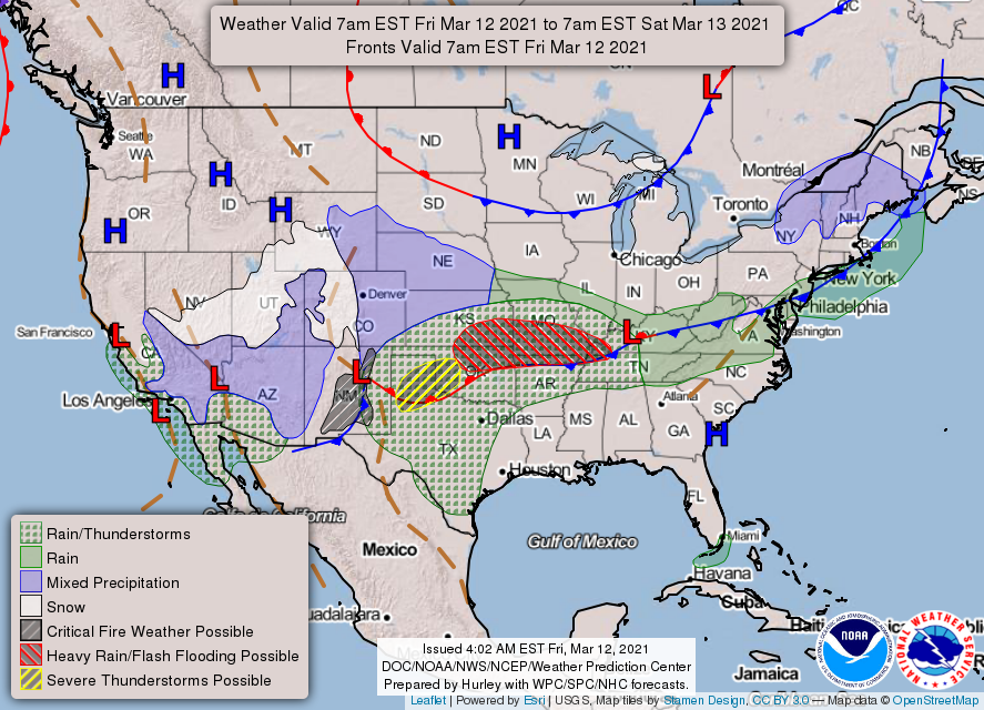
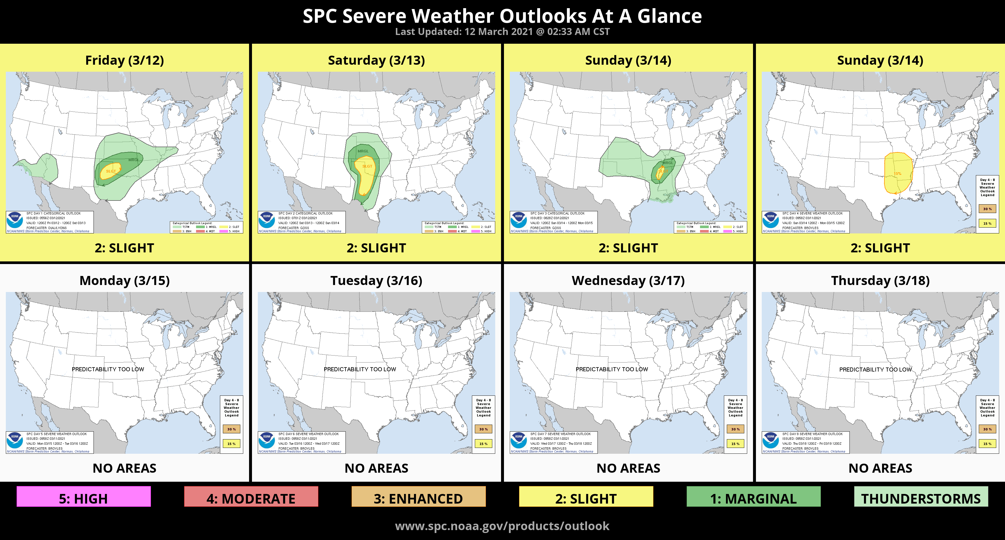
1- MARGINAL risk for possibly severe thunderstorms later today and tonight. As stated previously, the front that pushed through will be the focus point of the heavier storms. Right now, it runs from West-Central Texas to Waurika to McAlister to roughly Ft. Smith. It is forecast to back up over the area. Where it decides to stall out will be the focus area. We’ll have to wait and see where that actually occurs and then we’ll adjust accordingly.
2- If you plan on traveling southwest, PAY CLOSE ATTENTION to weather reports especially later today. Large hail and damaging winds are the main threats today and for Saturday, we’ll add a tornado threat. We’ll just have to wait and see where that threat will be highest. DON’T WORRY, just be prepared just in case.
3- Download our GARFIELD COUNTY EM app so you’ll get advisories and warnings directly from the NWS/NORMAN and GCEM. It’s loaded with preparedness info that will help you get ready for the storms. Overall, we’ll be ok so I will send out messaging over the app later this morning or early this afternoon as information updates.
4- If we come under severe conditions, I will go live on facebook instead of typing a lot of messages. The shortcut to our emergency management page on facebook is @EGCEM and yes, its all caps. Follow that page and hopefully their system notifies you.
5- Here is your forecast from the NWS/NORMAN;
Friday-Showers and possibly a thunderstorm. Some of the storms could produce heavy rainfall. High near 58. East northeast wind 7 to 9 mph. Chance of precipitation is 80%. New rainfall amounts between a quarter and half of an inch possible.
Friday Night-Showers and possibly a thunderstorm. Some of the storms could produce heavy rainfall. Low around 51. East northeast wind 7 to 10 mph. Chance of precipitation is 90%. New rainfall amounts between a quarter and half of an inch possible.
We’ll advise as needed. NWS graphics weren’t updated at 4 am this morning. I will send them later this morning.
Mike