0405L-THURSDAY OUTLOOK & INFO FROM GARFIELD COUNTY EMERGENCY MGMT-3/19/2020
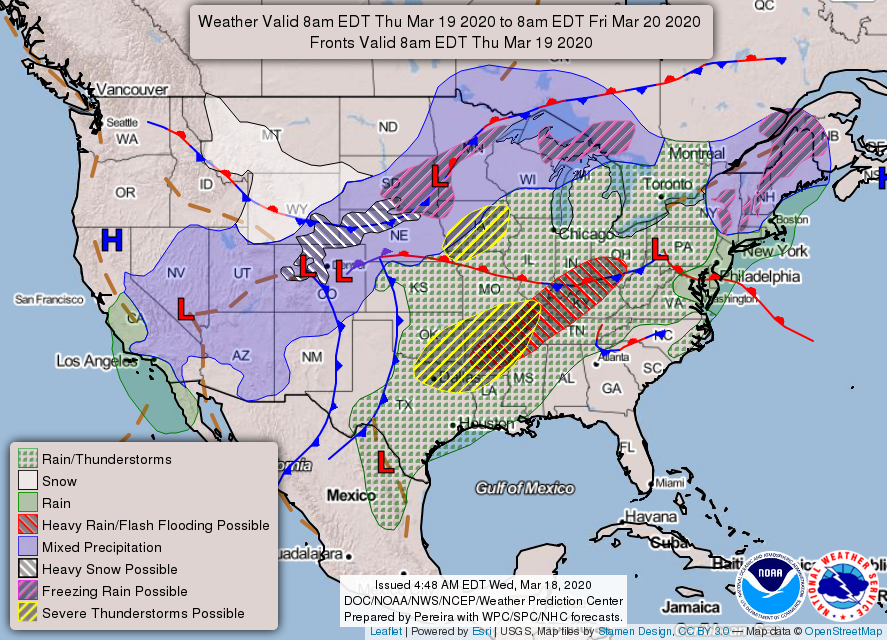
1- Severe weather is occurring in the OKC area right now-0345L. Those storms are moving to the NE and will not affect us. We do have some thunderstorms to our SW and they should affect our county within an hour. Unless these increase dramatically, expect gusty winds, lightning, some thunder, and possibly torrential rainfall at times. Storms should be out of here sometime this morning. We are in a WIND ADVISORY from 10am until 7pm this evening.
2- Winds will become very strong out of the SW today 25-35 mph possibly gusting near 50mph then tonight winter returns with a cold front bringing our temps back down around freezing during the overnight hours. Remember when I said keep a coat and umbrella in your vehicle? This is why.
3- We have added a new icon called COVID-19 to our GARFIELD COUNTY EM app. It apparently has an issue or two depending on the phone you have. Around mid-morning, I will do a Facebook live broadcast explaining this and hopefully can resolve any issues with your phones. We have given our GARFIELD COUNTY HEALTH DEPARTMENT access to the app for important info from them in this icon under COVID-19 LOCALNEWS. I’ll explain all of this around mid-morning. THE SHORTCUT ON FACEBOOK IS @EGCEM and this is all caps.
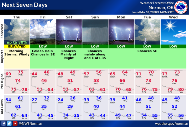
4- Overall, we will survive the weather, the biological issues, and HOPEFULLY we can calm everyone’s nerves so panic goes away. No reason for it anyway. Here is your forecast from the NWS/NORMAN;
Today-Mostly cloudy early in the morning then clearing. Windy. Highs in the mid 70s. South winds 15 to 25 mph shifting to the southwest 25 to 30 mph in the afternoon.
Tonight-Mostly clear. Much colder. Lows in the lower 30s. Southwest winds 15 to 25 mph shifting to the northwest 20 to 25 mph after midnight.
HAVE A SUPER DAY!!
MIKE