0405L-WEDNESDAY OUTLOOK & INFO FROM GARFIELD COUNTY EMERGENCY MGMT-3/18/2020
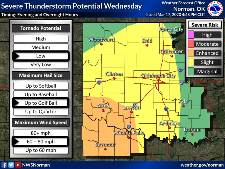
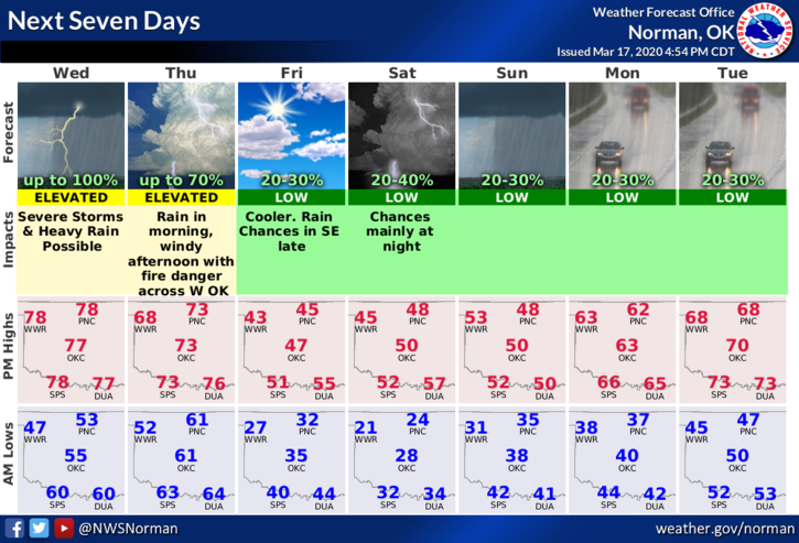
1-We are in a SLIGHT RISK for severe weather later this evening and overnight. Wind, hail, some flooding in low lying areas, and a very low threat for tornadoes are the main issues. This said, just be prepared for some bumpy weather later tonight. The graphs attached will change some during the day so don’t get too fixated on them. By the way, we may see some sunshine for a while this afternoon. Here is your forecast from the NWS/NORMAN;
Wednesday-Areas of drizzle and fog before 10am. Otherwise, cloudy through mid-morning, then gradual clearing, with a high near 76. South southwest wind 10 to 15 mph increasing to 15 to 20 mph in the afternoon. Winds could gust as high as 28 mph. Chance of precipitation is 10%.
Wednesday Night-Slight chance showers and possibly thunderstorms after 1am. Some of the storms could be severe. Low around 59. South wind 10 to 15 mph, with gusts as high as 23 mph. Chance of precipitation is 80%.
2- I will post more info on our COVID -19 Situation later today. Garfield County Health Department folks will be trained today on pushing information out to you through our GARFIELD COUNTY EM app. Several were out of town yesterday and we had to fix a small bug that showed up. Also, remember that you have to go into the settings of the app to turn on and off the CDC alerts. I posted instructions yesterday.
Have a Super day!!
MIKE