FROM GARFIELD COUNTY EMERGENCY MANAGEMENT
Good morning,
As we transition into spring, we now look to possibilities of having some severe weather. Severe storms have been happening since time began in some way, shape, or form. Are they to be feared? According to the panic department in OKC? Yes. In MY world of Public Safety? NO. Now, keep in mind that ratings are involved down south. Knowledge is involved here and many other places.
That said, we cannot stop storms but you can lesson your level of anxiety, depression, and hopelessness by listening to our LOCAL radio stations without the hype. You will get information in a tone of voice that will be direct but calm so you can take that info and apply it to what you may need to do to weather the storms. Our operations center will coordinate with our radio, blog, and newspaper folks and send out information that will help you understand what is going on and what precautions you may need to take in order to weather the storms.
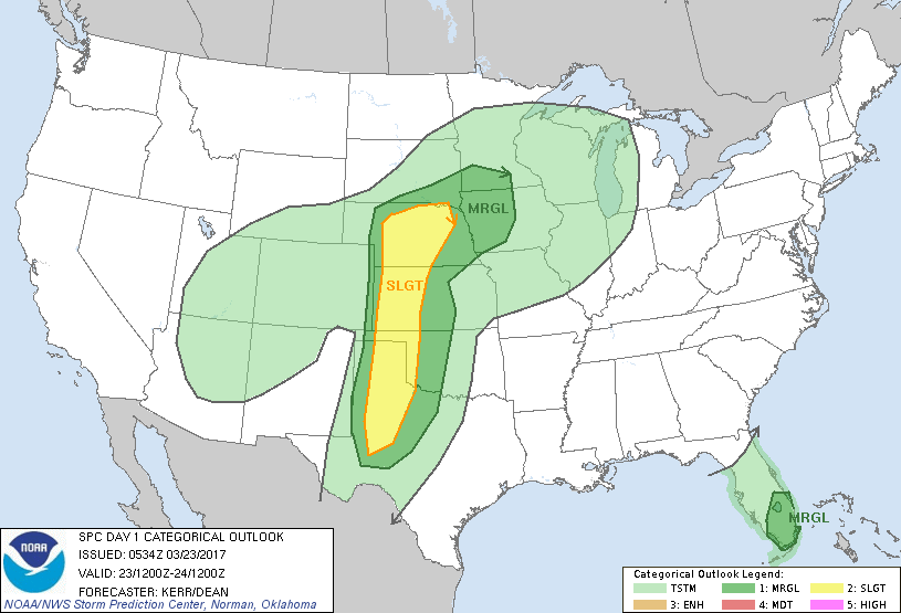
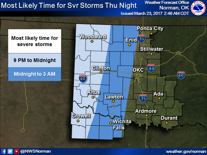
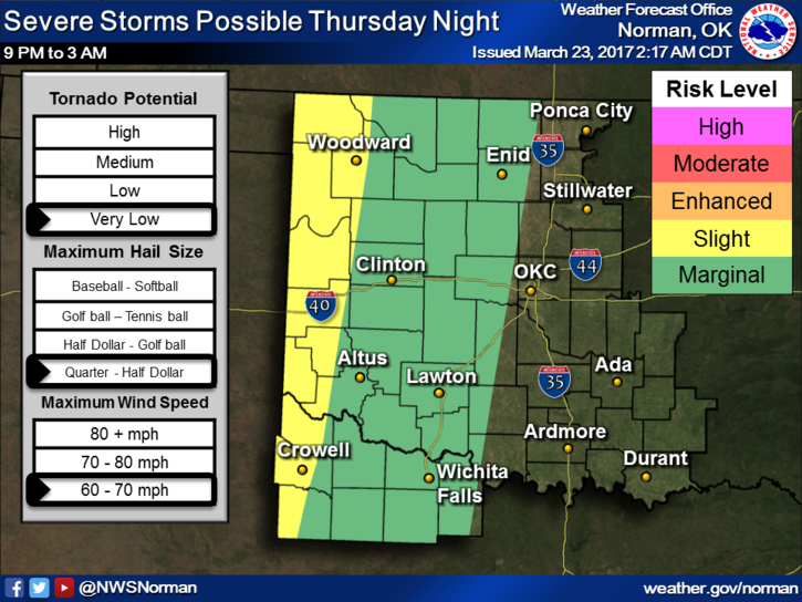
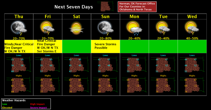
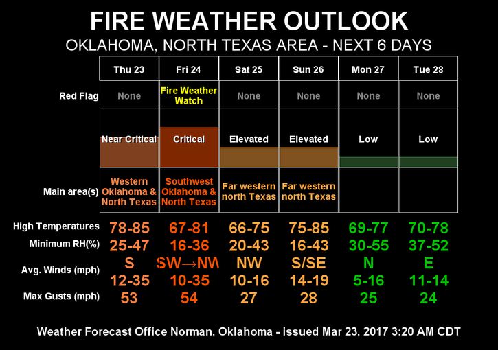
Our threat will be a bit higher this weekend but understand all the variables do change some day to day. Stay up with the latest from the NWS and GCEM through our GARFIELD COUNTY EM app and our LOCAL sources of information without the hype. We’ll keep you well informed without having to take supplements to calm you down. Here is your forecast from the NWS/NORMAN;
Today-Mostly sunny, with a high near 80. Windy, with a south wind 14 to 19 mph increasing to 27 to 32 mph in the afternoon. Winds could gust as high as 45 mph.
Tonight-50 percent chance of showers and thunderstorms after 1am. Mostly cloudy, with a low around 59. Windy, with a south southeast wind 23 to 28 mph, with gusts as high as 39 mph. New rainfall amounts of less than a tenth of an inch, except higher amounts possible in thunderstorms.
HAVE A SUPER DAY!!
MIKE