FROM GARFIELD COUNTY EMERGENCY MANAGEMENT
GOOD MORNING,
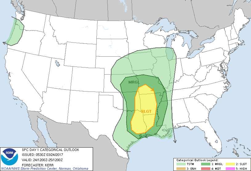
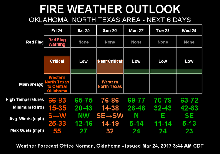
First of all, our TASK FORCE 2 has returned home after helping Noble County with their fire last night. Our TASK FORCE 3 is now on standby for deployment in the event another request occurs. That said, we are in a RED FLAG WARNING FROM 11AM UNTIL 7PM TONIGHT. There is also a MARGINAL RISK for thunderstorms today. Thinking is that they will mostly occur east of I-35. We’ll wait and see if we can actually get lucky and squeeze some rain out here today.
The risk for severe weather here Sunday has lessened some but it still appears we could see at least some rain. Timing is still an issue so we can only hope. I am not hoping for severe weather but if that is what it takes to receive rain, so be it. We just need the rainfall.
That said, here is your forecast from the NWS/NORMAN;
Today-20 percent chance of showers after 4pm. Mostly sunny, with a high near 77. Windy, with a south wind 23 to 26 mph, with gusts as high as 37 mph.
Tonight-20 percent chance of showers before 1am. Mostly cloudy, with a low around 46. East northeast wind 13 to 18 mph becoming northwest after midnight. Winds could gust as high as 25 mph.
HAVE A SUPER DAY!!
MIKE