FROM GARFIELD COUNTY EMERGENCY MANAGEMENT
Good morning,
The spotter class last night went well. We had 50 people show up. It was surprising that we had 14 people who had never been to a class before so hopefully they got something out of this class. One thing I wanted to mention is that during any storm, you can relay information to us through our GARFIELD COUNTY EM app. Use the DAMAGE REPORT icon to send any type of report. As stated last night, it will also be time stamped and we will use this information for assessment purposes and warning criteria during severe weather. We will then forward it to the NWS.
That said, it will be cooler today so spring and summer will have to wait several more days to take a strong hold on the area. Rain chances are in the air too. That stated, next week MAY give us better chances for rain. We’ll just have to wait and see.
Here is your forecast from the NWS/NORMAN AS OF 0410 LOCAL TIME
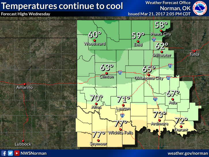
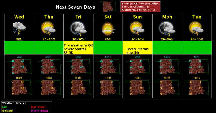
Wednesday-Cloudy, with a high near 59. Northeast wind 9 to 16 mph, with gusts as high as 23 mph.
Wednesday Night-20 percent chance of showers and thunderstorms. Mostly cloudy, with a low around 52. East wind 9 to 13 mph.
HAVE A SUPER DAY!!
MIKE