0420L-THURSDAY OUTLOOK FROM GARFIELD COUNTY EMERGENCY MANAGEMENT-3/28/19
GARFIELD COUNTY EM. This is our notification app. If you don’t have it, you’re NOT prepared.
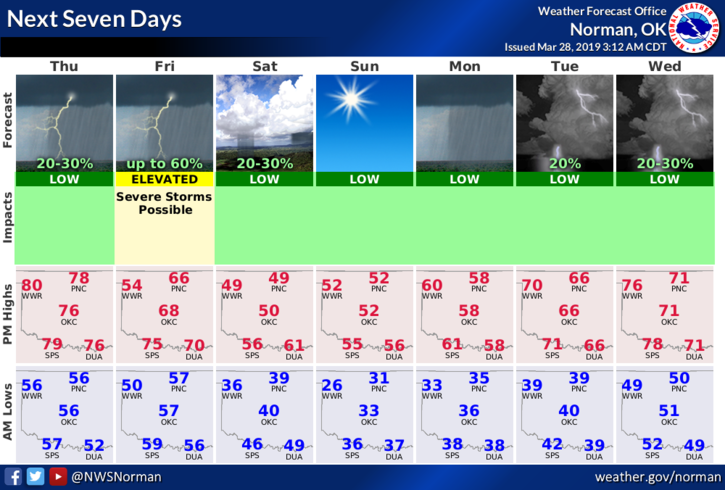
1- We are in a “GENERAL” thunderstorm risk area for today. IF thunderstorms occur, we don’t anticipate any severe weather per guidance. REMEMBER, this can change. We do have a strong cap above us that may suppress thunderstorm activity. We’ll see how all of this plays out.
2- Overall, we’ll wait and see how the storm system out west, the cold front up north, and moisture from the gulf all come together. TIMING, as always will make the difference.
3- Here is your forecast from the NWS/NORMAN;
Today-Mostly cloudy, slight chance of thunderstorms late this afternoon. Highs in the upper 70s. South winds 15 to 20 mph. Chance of thunderstorms 20 percent.
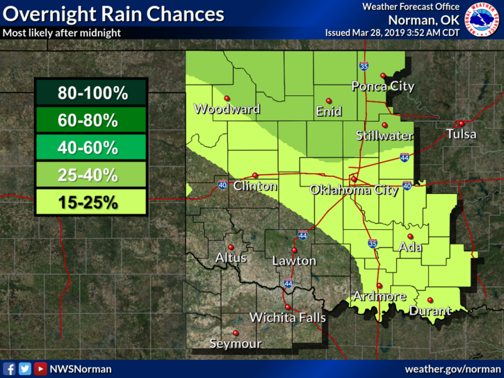
Tonight-Mostly cloudy, slight chance of thunderstorms in the evening and overnight. Lows in the upper 50s. South winds 10 to 15 mph. Chance of precipitation 30 percent.
HAVE A SUPER DAY!!
MIKE