0355L-THURSDAY OUTLOOK & INFO FROM GARFIELD COUNTY EMERGENCY MGMT-3/5/2020
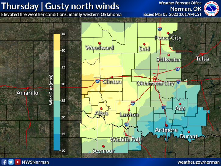
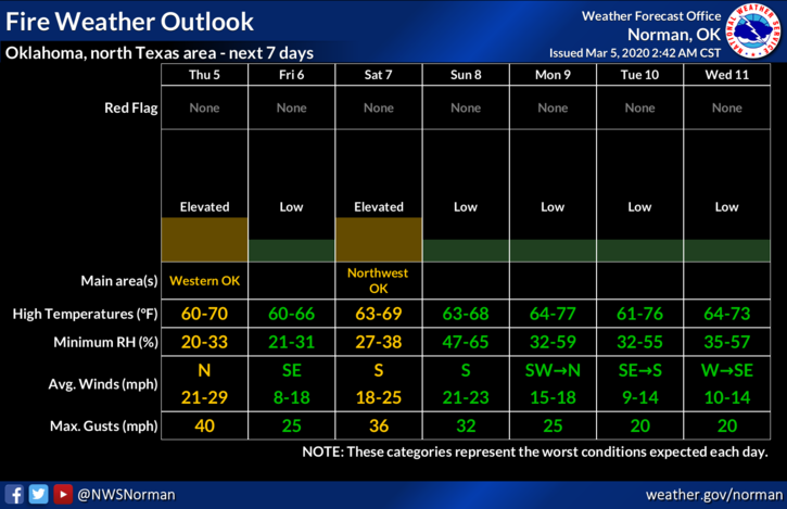
1-Another front will push through today bringing strong winds with it but it also should be dry. Temperatures shouldn’t be affected too much with this but the FIRE DANGER will go up a bit. I would state that no burning should be done until after the winds lay down later today. If you see smoke or fire, call 911.
2- Day 2 of our NWEM Workshop is in the books and today we will destroy an Enid landmark but only in our imaginations. We will have a tabletop exercise around 10am until noon and talk through a disaster scenario. We will have all representatives of the agencies that would actually respond so the discussion will be good. Having other emergency managers, law enforcement, fire service, public works, health department, and other state officials here will enhance this discussion as the scenario could actually occur anywhere. State Emergency Management officials will facilitate the exercise. It will be a good one.
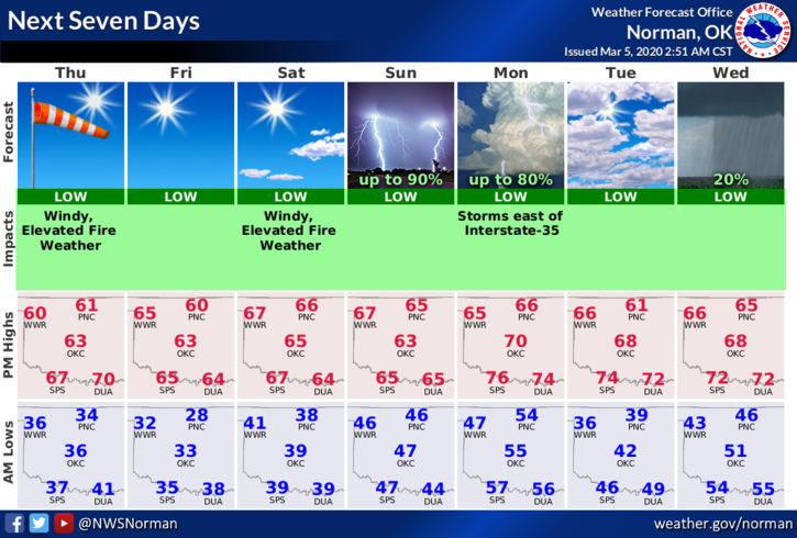
3- Weather-wise, a front will push in and bring strong winds with it. Don’t think there will be any rain per guidance so tie down anything that could take flight. We’ll be ok. Here is your forecast from the NWS/NORMAN;
Thursday-Sunny with a high near 61. Windy with a west wind 5 to 15 mph becoming north 20 to 25 mph in the morning. Winds could gust as high as 36 mph.
Thursday Night-Clear with a low around 31. North northwest wind 5 to 10 mph.
HAVE A GREAT DAY!!
MIKE