FROM GARFIELD COUNTY EMERGENCY MANAGEMENT-THURSDAY, 5/11/17
Good morning.
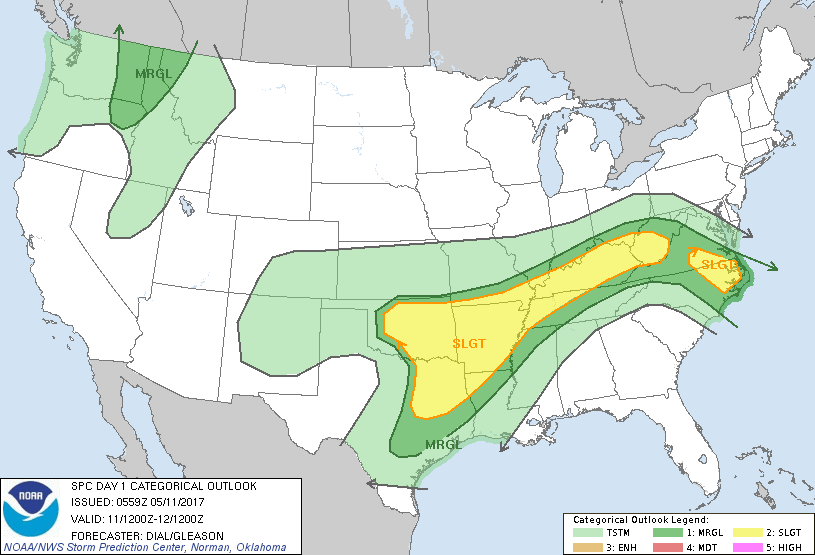
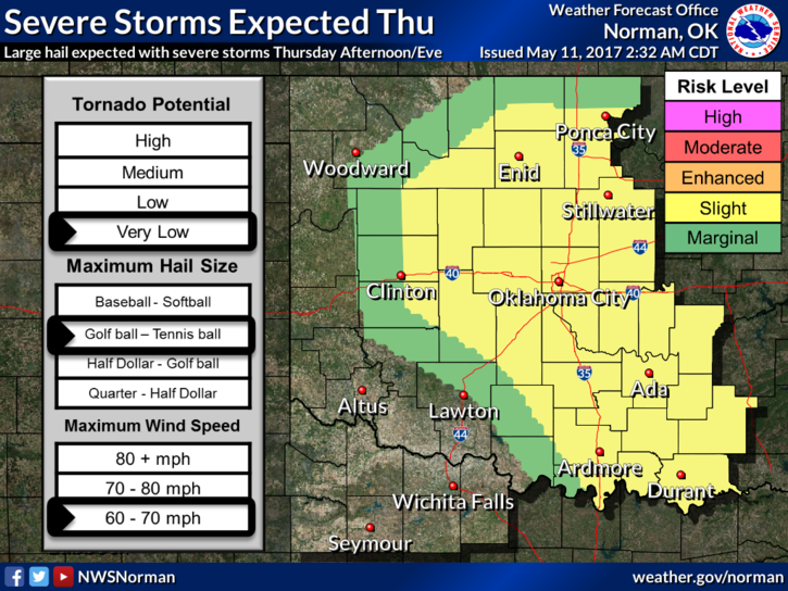
We are in a SLIGHT RISK for severe weather later today. A storm system over NE New Mexico and a cold front up in Kansas will come together for some enlightening weather later today. No pun intended. Our biggest risk looks to be hail and damaging winds with the stronger storms, although the “t” risk is there, it is very low at this time. I will update this later this morning when I wake up if things do, by chance change. Today will be similar to yesterday.
If we do suffer any type of damage, please send me a damage report preferably through our GARFIELD COUNTY EM app. Otherwise, take pictures and email me at mike@gcem.org I do keep a record of damages by date now that we have this ability through our app.
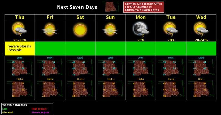
Overall, after reading all the discussions this morning, yes we will see some hefty weather but again we will be ok. Nothing to panic about at least yet. That said, here is your forecast from the NWS/NORMAN;
Thursday-Showers and thunderstorms likely, mainly after 1pm. Mostly cloudy, with a high near 76. South southeast wind 5 to 10 mph becoming north northwest in the afternoon. Chance of precipitation is 70%. New rainfall amounts between a tenth and quarter of an inch, except higher amounts possible in thunderstorms.
Thursday Night-A chance of showers and thunderstorms before 1am, then a slight chance of showers. Mostly cloudy, with a low around 53. North wind 13 to 15 mph, with gusts as high as 21 mph. Chance of precipitation is 40%.
HAVE A SUPER DAY!!
MIKE