0350L-THURSDAY OUTLOOK FROM GARFIELD COUNTY EMERGENCY MANAGEMENT-5/13/21
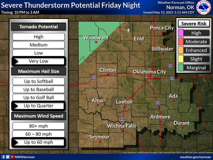
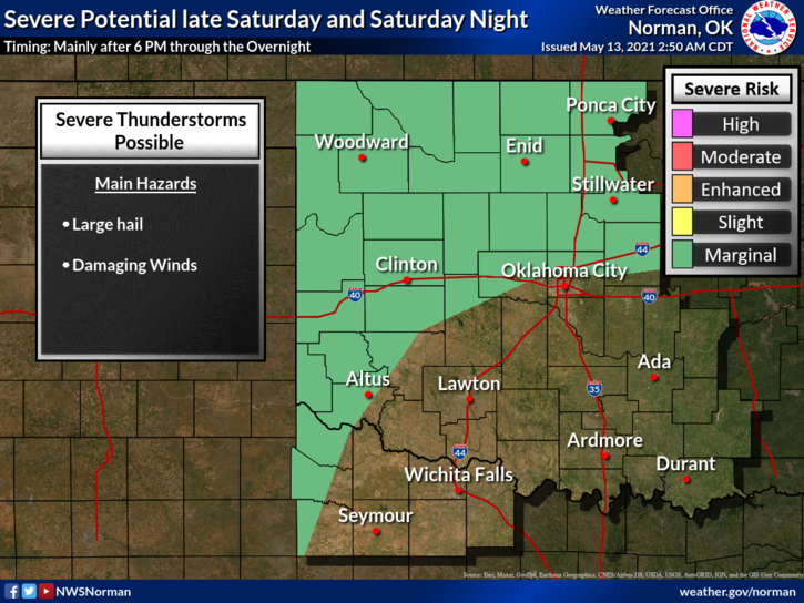
1- We are in a GENERAL Thunderstorm risk for today meaning it’s really low. We MIGHT see remnants of convection in our area late from any storms that fire up in Kansas. On Friday the severe risk will be Marginal in far NW OK and on Saturday, we’ll be in that Marginal area according to guidance. Main threats will be hail and winds if they occur. Any storms that we have will be mostly overnight storms. We’ll see what happens.
2-Our app- GARFIELD COUNTY EM is unlike most as we give you good information to prepare for events or disasters. There are areas within the app for you to store personal information. This post is under the GCEM BLOG each day on the app. You can register your storm shelter or safe area from the app. Important numbers are listed under EMERGENCY CONTACTS and all you have to do is tap that agency and it calls them. NATIONAL WEATHER SERVICE warnings and advisories automatically come thru this app so when severe events are forecast, rest assured this information should come through. JUST REMEMBER that anything you rely on that comes through your phone depends on YOUR PHONE CARRIER. Choose that carrier wisely. If the internet goes down, that could affect your phone too. HAVE 3 WAYS TO GET EMERGENCY INFORMATION AT ALL TIMES.
3- FINALLY, making emergency decisions is difficult when you are in an emotional state. Being prepared helps to keep you calm simply because you know what’s coming and you have prepared for it. Having our app helps you in this process.
Here is your forecast from the NWS/NORMAN;
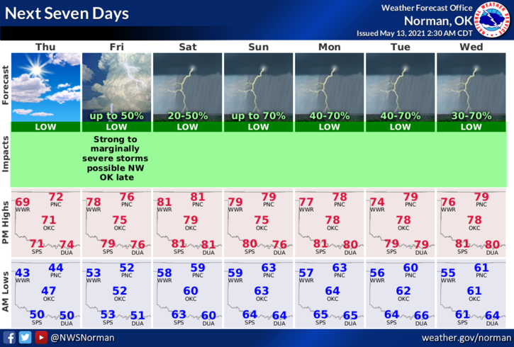
Today-Sunny. Highs in the lower 70s. Southeast winds up to 10 mph increasing to 10 to 15 mph in the afternoon.
Tonight-Mostly clear. Lows in the lower 50s. South winds 10 to 15 mph.
HAVE A GOOD DAY!!
MIKE