FROM GARFIELD COUNTY EMERGENCY MANAGEMENT
“TAKE THE TIME TO READ THIS POST IN ITS ENTIRETY. “
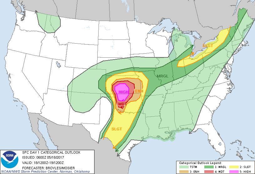
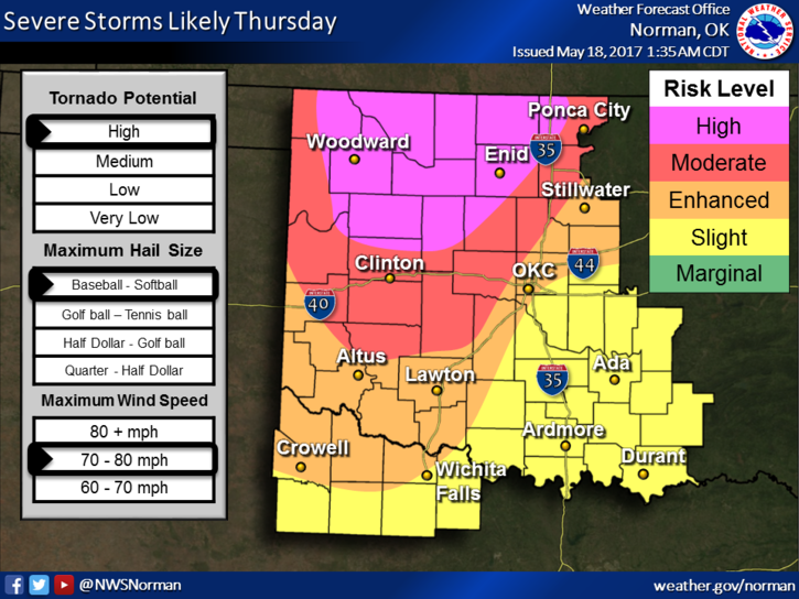
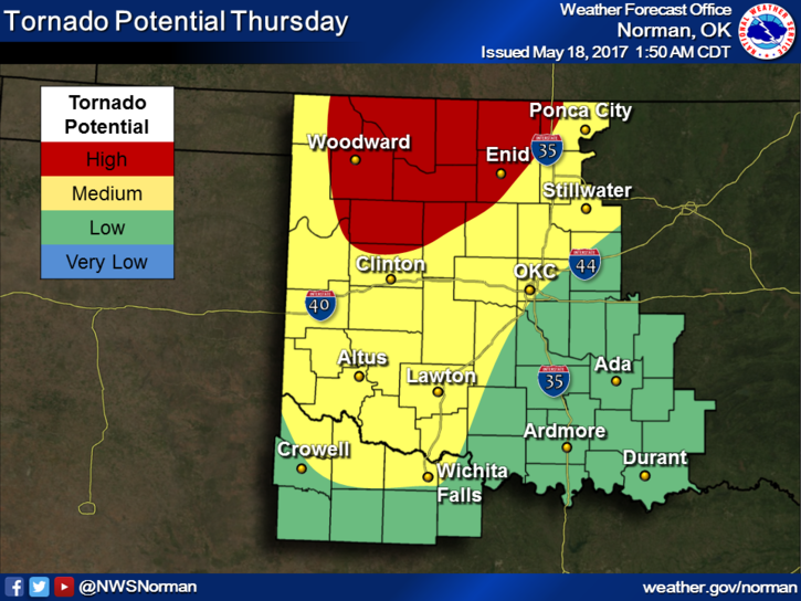
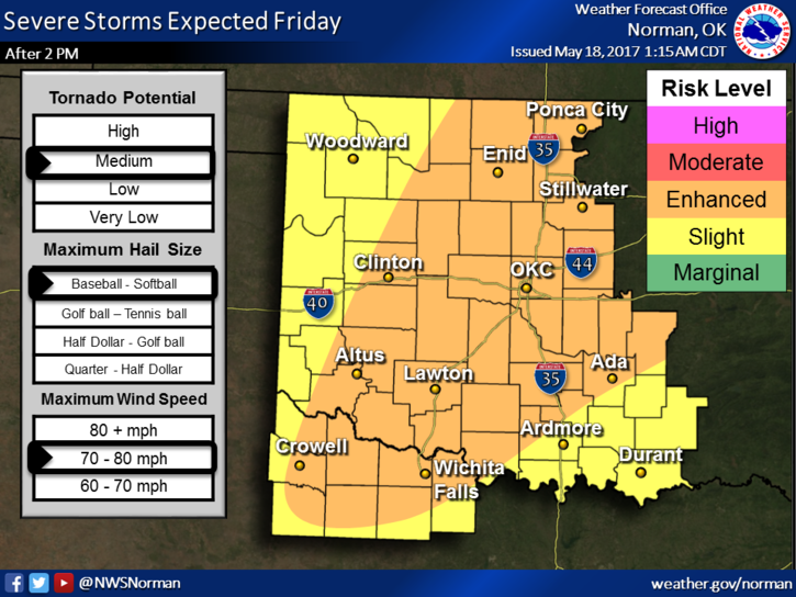
ATTENTION!!! WE ARE IN A “HIGH” RISK AREA FOR SEVERE WEATHER LATER TODAY.
“TIMING”-ROUGHLY 2PM UNTIL 10 PM. THIS MAY CHANGE A LITTLE
“HAZARDS”-LARGE LONG TRACK TORNADOES, SOFTBALL SIZE HAIL, WINDS AROUND 80 MPH.
TODAY IS A GOOD DAY TO DOWNLOAD OUR “GARFIELD COUNTY EM” APP. JUST FYI, NWS WARNINGS AUTOMATICALLY COME THROUGH OUR APP. You’ll get local info from us that other apps don’t allow.
This said; make arrangements NOW so you know what you will do in case we actually have tornadoes. DO NOT WAIT UNTIL THE SIRENS GO OFF OR WARNINGS ISSUED BEFORE MAKING THESE DECISIONS. Our decisions are based on “our” operations center information and our local spotter network. We rely on those folks heavily. This said, our spotters are rural fire folks, OHP, Enid Police, and Sheriff Personnel, and they will all be out there in specified areas keeping an eye out.
DOES THIS MEAN WE WILL HAVE TORNADOES? NO, BUT CONDITIONS ARE THERE.
DOES THIS MEAN WE WILL HAVE 80 MPH WINDS? NO, BUT CONDITIONS ARE THERE.
DON’T PANIC. There is no need too. We’ll see where everything sets up and adjust. That’s all we can do. Get prepared and we should be ok.
Today-40 percent chance of showers and thunderstorms after 1pm. Partly sunny, with a high near 85. South wind 9 to 18 mph, with gusts as high as 25 mph
.Tonight-Showers and thunderstorms likely, mainly before 1am. Mostly cloudy, with a low around 65. South southeast wind 10 to 18 mph, with gusts as high as 25 mph. Chance of precipitation is 60%. New rainfall amounts between a quarter and half of an inch possible.
HAVE A GREAT DAY AND WE’LL ADVISE AS NEEDED.
MIKE