0425L-THURSDAY OUTLOOK FROM GARFIELD COUNTY EMERGENCY MANAGEMENT-5/2/19
1-CLOUDY WITH CHANCES FOR DRIZZLE, RAIN AND MAYBE A THUNDERSTORM. This pretty much sums up today and possibly tomorrow. We had a cold front push through overnight with some rainfall but nothing major as of 4:15 am this morning.
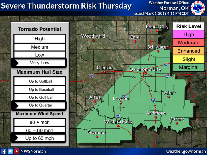
2- Overall for today, cloudy with a good chance for showers. We are in a GENERAL RISK for thunderstorms so we’ll continue to deal with this and hopefully we’ll see the sun this weekend.
3- If you plan on traveling, especially south, check the forecast and watch out for flooding issues. Some places in southern Oklahoma have received 5-8 inches of rain in some areas.
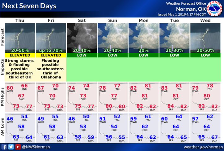
4- Here is your forecast from the NWS/NORMAN;
Thursday- Showers and thunderstorms likely mainly before 10am. Cloudy with a high near 61. North northeast wind 10 to 15 mph, with gusts as high as 20 mph. Chance of precipitation is 60%. New rainfall amounts of less than a tenth of an inch, except higher amounts possible in thunderstorms.
Thursday Night- 40 percent chance of showers and thunderstorms, mainly after 1am. Cloudy with a low around 53. Northeast wind 5 to 10 mph.
Finally, be sure and download our GARFIELD COUNTY EM app. Being prepared is YOUR choice.
Have a good day.
Mike