0430L-WEDNESDAY OUTLOOK FROM GARFIELD COUNTY EMERGENCY MANAGEMENT-5/1/19
GARFIELD COUNTY EM = PREPAREDNESS. YOU HAVE IT OR YOU DON’T. Your choice!
COMMENT- THANK YOU ALL for sending your rainfall totals and damage reports to us through the app and our gcem.org website. They are appreciated!!
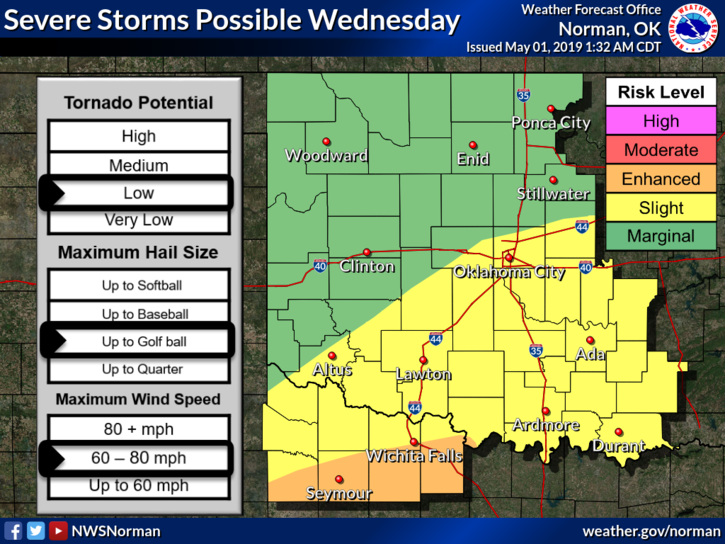
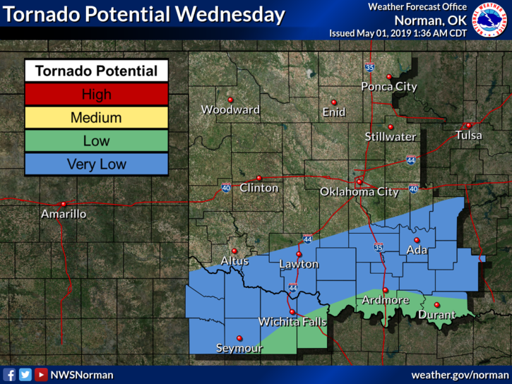
1- We are in a MARGINAL RISK AREA for severe weather today. Though chances are low, we can’t rule out anything as the day goes forward. The higher risk will be along a cold front to our southeast and east, similar to yesterday.
2- Heavy storms will be focused along that boundary. Some storms will be severe mainly due to hail size and winds. CAUTION, we can get severe weather here just as easy depending where boundaries end up so stay weather aware today.
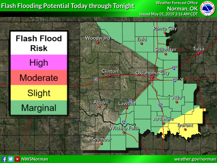
3- If traveling, pay attention to the forecast and weather conditions in the area you are going as there are flood risks involved today.
4- ANY UPDATES throughout the day will be sent out over our app so be sure to download it.
5- Here is your forecast from the NWS/NORMAN;
Wednesday-20% chance for thunderstorms today. Cloudy with a high near 74. Northeast wind 5 to 10 mph becoming south in the afternoon.
Wednesday Night-50 percent chance of showers and thunderstorms, late. Mostly cloudy with a low around 54. South wind around 10 mph becoming north after midnight. New rainfall amounts between a tenth and quarter of an inch, except higher amounts possible in thunderstorms.
HAVE A GOOD DAY AND I’LL ADVISE IF NEEDED.
MIKE