0405L-FRIDAY OUTLOOK FROM GARFIELD COUNTY EMERGENCY MANAGEMENT-5/3/19
GARFIELD COUNTY EM = PREPAREDNESS. IT’S YOUR CHOICE!
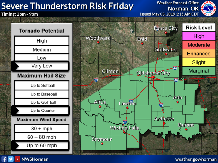
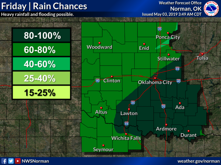
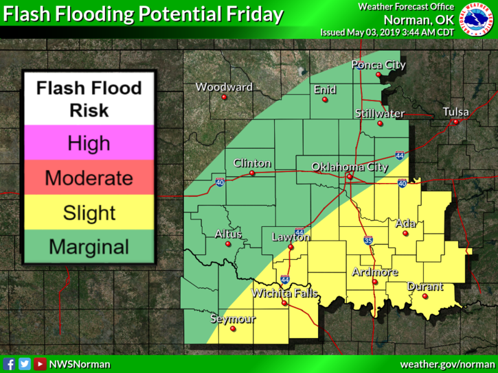
1- Showers with embedded thunderstorms are possible today as a trough moves over the area followed by another cold front. Therefore we are in a GENERAL RISK area for severe weather. If storms occur, hail and winds would be our main threats along with torrential rainfall.
2- If traveling around the area, stay cautious as some roads in low lying areas may still be a bit muddy. Also, on that note, check forecast at your destination before leaving. Road conditions are on the front page of our gcem.org website for all states surrounding Oklahoma.
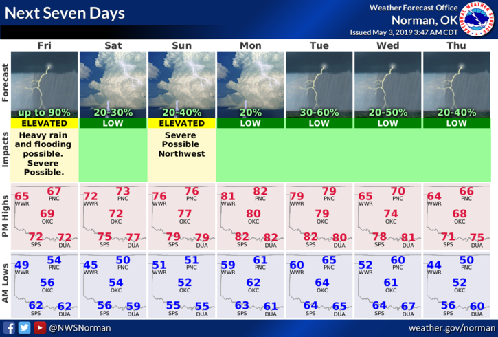
3- Here is your forecast from the NWS/NORMAN;
Friday-Showers and thunderstorms mainly before 1pm. High near 66. Northeast wind around 5 mph. Chance of precipitation is 80%. New rainfall amounts between a half and three quarters of an inch possible.
Friday Night-20 percent chance of showers before 1am. Mostly cloudy with a low around 49. North wind around 6 mph.
We’ll advise as needed.
MIKE