0300L-THURSDAY UPDATE FROM ENID/GARFIELD COUNTY EMERGENCY MANAGEMENT-5/31/18
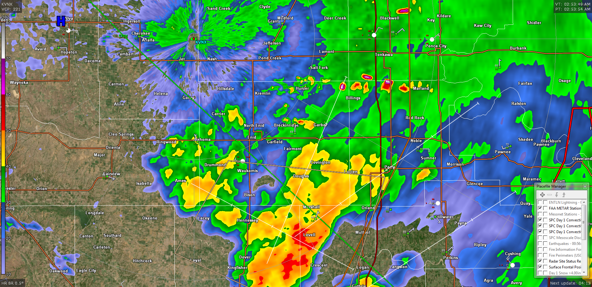
1-WE ARE IN A SEVERE THUNDERSTORM WATCH UNTIL 5 AM THIS MORNING. STORMS CONTINUE TO DEVELOP AROUND THE AREA. IF STORMS GO SEVERE, IT WOULD MOST LIKELY BE DUE TO WINDS. The attach radar pic is from around 3 am this morning depicting the mess out there.
2- Storms in the area are not severe but remain a little noisy. This will be ongoing for a while this morning. The most dangerous thing about these cells is the lightning as of right now. Be extremely careful out there. We do expect a front to push through today shifting winds to the NNW. This should help in stabilizing the atmosphere.
3- After this mess moves out, we’ll deal with the heat and the heat index. We’ll be close to 97 for HEAT INDEX issues later today and we may even be close to triple digits in actual temps on Friday. Overall, if you work outside, pace yourself and take breaks. You want to remain hydrated.
4- Here is your forecast from the NWS/NORMAN;
Thursday-Mostly cloudy, then gradually becoming sunny, with a high near 92. Heat index values as high as 97. East southeast wind 6 to 9 mph.
Thursday Night-Mostly clear, with a low around 72. East wind around 7 mph.
HAVE A SUPER DAY!!
MIKE