0350L-FRIDAY UPDATE FROM ENID/GARFIELD COUNTY EMERGENCY MANAGEMENT-6/1/18
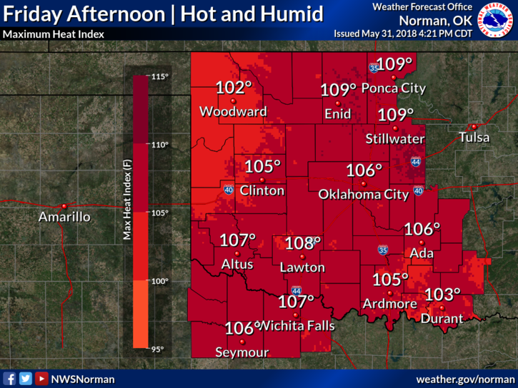
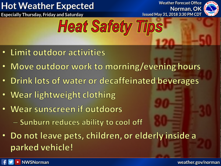
1-We are in a HEAT ADVISORY FROM NOON TODAY UNTIL 10PM TONIGHT. HEAT INDEX VALUES COULD REACH 109.This said, HOT is the key word for at least today. If you plan on doing anything outside especially this afternoon and evening, PACE YOURSELVES. With our temps in the low to mid 90’s and dew points in the low 70s, heat stress may occur while working outdoors. Be careful!
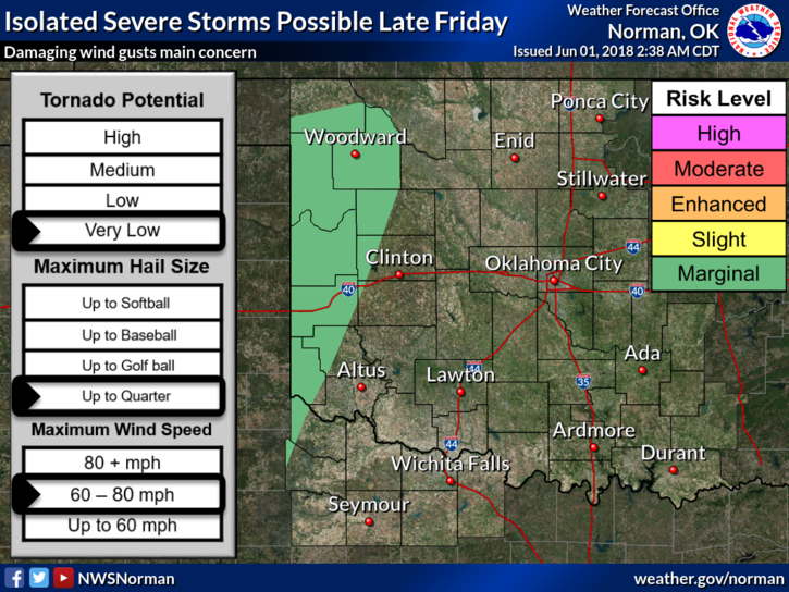
2-There is a MARGINAL RISK for severe weather out west later today so IF storms form out there, wind and hail will be the main threats. Stay weather aware if traveling.
3-We are expecting a front SATURDAY afternoon and it should come through dry. We will cool down a little but be prepared for a hot week coming up. The pattern we’ll be in MIGHT be such that we have overnight thunderstorms next week. We’ll see how all of this works out.
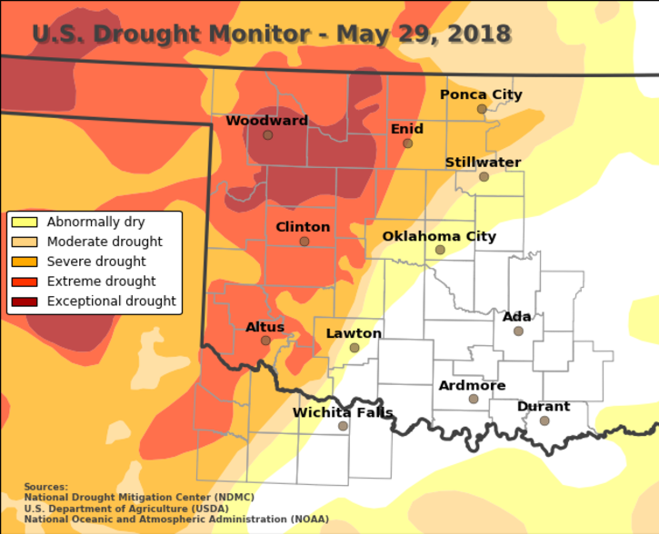
4-We are still split between an extreme and severe drought conditions. Yes, even the rain we have received still isn’t enough to pull us out right now. There is no burn ban in effect here in Garfield County so if you plan on burning, call dispatch and let them know and we’ll be advised. Thank you. You can find all department numbers here- https://gcem.org/emergency-numbers/
5– Here is your forecast from the NWS/NORMAN;
Friday-Sunny and hot with a high near 100. Heat index values as high as 108. South southeast winds 5 to 15 mph with gusts as high as 20 mph.
Friday Night-Partly cloudy with a low around 74. South southeast wind 10 to 15 mph with gusts as high as 25 mph.
HAVE A SUPER DAY AND STAY “COOL”
MIKE