0305L-THURSDAY OUTLOOK FROM GARFIELD COUNTY EMERGENCY MANAGEMENT-11/30/23
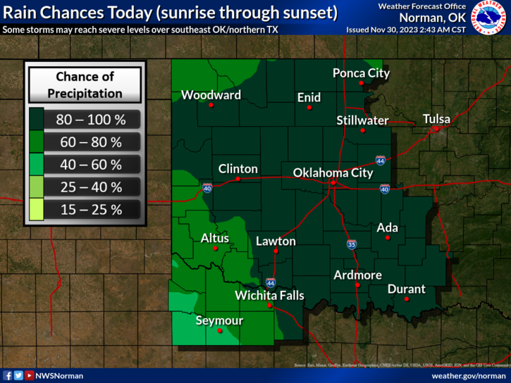
*Rain is possible in our area as a trough moves through during the day. There could be a dusting of snow overnight if we can get cold enough and precip remains over the area. Timing is the question on that right now. Severe weather, per guidance looks to be possible in southern Oklahoma so if traveling that way, stay up with the latest from the NWS.
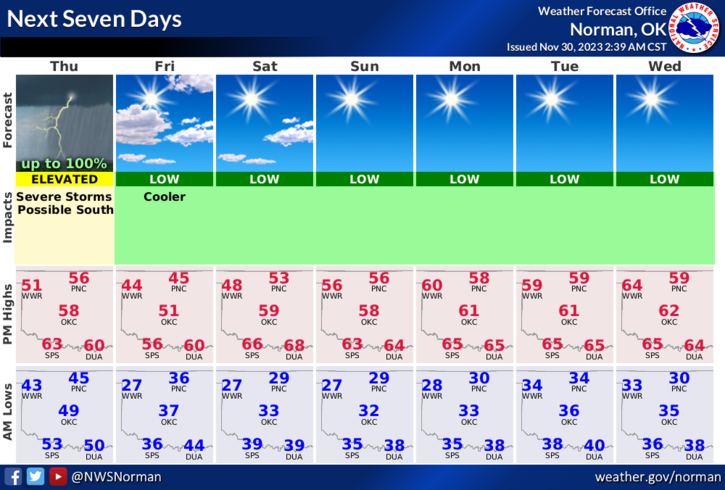
*Whatever happens for sure today will cool us down for Friday and then we’ll rebound back to seasonal temps and possibly above normal temps later in the weekend into next week. As always, we’ll deal with what nature throws at us.
*Overall, we’ll be ok so here is your forecast from the NWS/NORMAN;
Today- Cloudy. Showers with a slight chance of thunderstorms this afternoon. Highs in the upper 50s. South winds 10 to 15 mph. Chance of rain 90 percent.
Tonight- Cloudy. Rain showers with a chance of thunderstorms in the evening. Lows in the mid-30s. West winds 10 to 15 mph, becoming northwest after midnight. Chance of rain 90 percent.
*Be sure to download our GARFIELD COUNTY EM app and Enid’s CITY CONNECT app.
HAVE A GOOD DAY!