0305L-THURSDAY OUTLOOK FROM GARFIELD COUNTY EMERGENCY MANAGEMENT-10/13/22
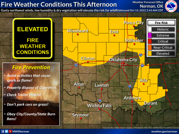
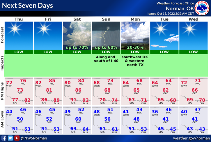
1- Changes are coming. Today and tomorrow will be warm, windy, with an Elevated Fire Danger. Another front will come through over the weekend bringing cooler air and MAYBE some rainfall. We could possibly see overnight low temps drop into the mid 30’s by Tuesday with daytime highs in the 60s.
2- Don’t hold your breath on any rain but if it occurs over the weekend, it probably won’t have too much of an affect on the region. I want to stress to everyone that as dry as we are, be extremely careful doing anything related to fire and call 911 if you see anything suspicious and if you see smoke and fire. Please don’t hesitate on either of these.
3- Overall, we’ll be ok so here is your forecast from the NWS/NORMAN;
Today- Sunny. Highs in the mid-70s. Northwest winds 5 to 10 mph, increasing to 15 to 20 mph with gusts up to 30 mph this afternoon.
Tonight- Clear. Lows in the upper 40s. West winds 10 to 15 mph.
HAVE A GOOD DAY!