0415L-THURSDAY OUTLOOK & INFO FROM GARFIELD COUNTY EMERGENCY MANAGEMENT-10/24/19
1- GARFIELD COUNTY EM– YOU’RE NOT PREPARED WITHOUT OUR APP.
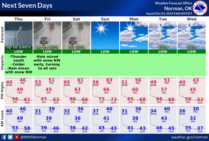
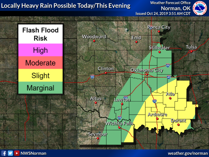
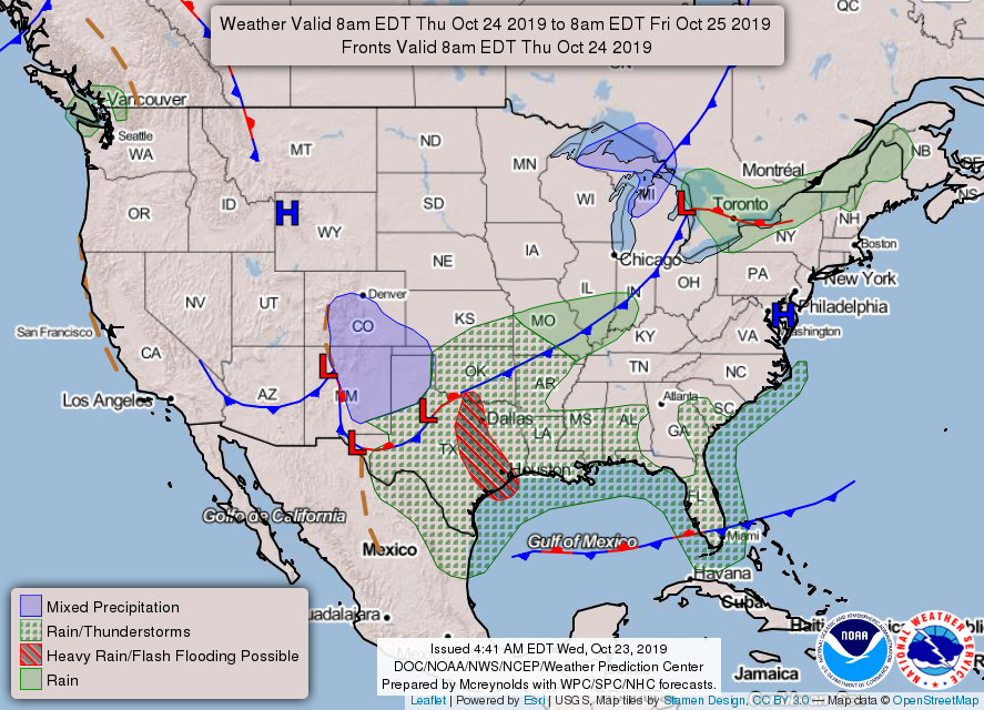
2- Rain is possible during the day and this evening as another front pushes colder air into the area. No severe weather is expected. Snow chances for us, UNLESS SOMETHING CHANGES DRAMATICALLY, are low until later tonight when temps drop at least into the mid 30’s. We’ll definitely see what happens.
3- Overall, we’ll survive either way. Here is your forecast from the NWS/NORMAN;
Today-A chance of showers and thunderstorms, then rain after 1pm. Temperatures falling to around 43 by 5pm. North wind 20 to 25 mph, with gusts as high as 35 mph. Chance of precipitation is 80%. New precipitation amounts of less than a tenth of an inch, except higher amounts possible in thunderstorms.
Thursday Night-Rain before 1am, then a chance of rain and snow. Low around 37. North wind 10 to 20 mph, with gusts as high as 25 mph. Chance of precipitation is 80%. Little or no snow accumulation expected.
HAVE A SUPER DAY!!
MIKE