0400L-THURSDAY OUTLOOK FROM GARFIELD COUNTY EMERGENCY MANAGEMENT-10/29/2020
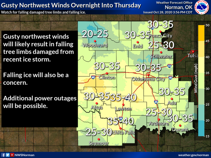
1- WIND ADVISORY in effect from now until 4pm this afternoon. North winds 20-30 mph with gusts to 40 are expected. Our temps ate 0320 this morning are at 40 degrees. Good melting has occurred overnight which will hopefully help the power issues we have had over the last several days. The unfortunate thing is that we will continue to have power issues due to limbs damaged or weakened from the ice storm.
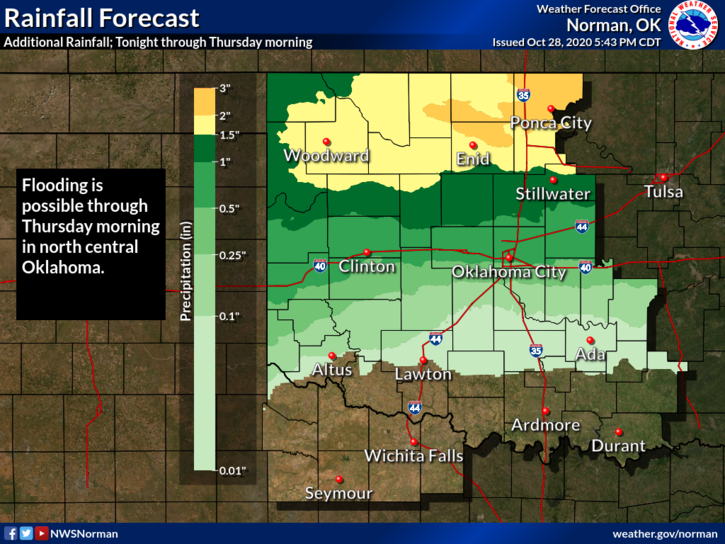
2- FLOOD WATCH in effect through this afternoon. As the upper low moves across the southern part of the state, it will bring rain, heavy at time to the area. 3-4 inches of rainfall is possible.
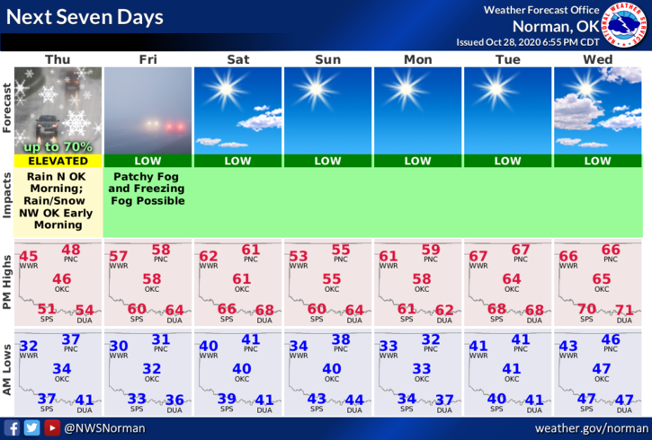
3- Overall, from Moderate Drought Conditions, Ice Storm Warnings, Flood Watches, to Wind Advisories all in a few days, I feel we’ve done ok. Tonight, there is a possibility of FREEZING FOG so be extra careful!!
4-Here is your forecast from the NWS/NORMAN;
Today-Mostly cloudy with rain likely in the morning, then sunny in the afternoon. Not as cool. Highs in the upper 40s. North winds 10 to 20 mph. Chance of rain 70 percent.
Tonight-Clear. Areas of dense freezing fog after midnight. Lows in the upper 20s. Northwest winds around 10 mph in the evening becoming light and variable.
HAVE A GOOD DAY!!
MIKE