0345L-THURSDAY OUTLOOK & INFO FROM GARFIELD COUNTY EMERGENCY MANAGEMENT-10/31/19
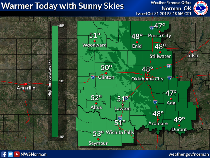
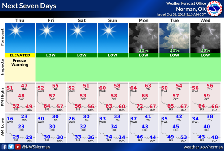
1- Ahhh, a taste of winter. The snow came and the snow went. It’s still chilly outside. That said, after a very cold morning, we MIGHT reach our forecast high of around 45 degrees. Yes, it will be a little warmer today but guess what? Another front will push in Friday bringing that warmup to an end. We’ll try to warm up again over the weekend then yet another front is expected later on Monday then possibly later next week. Guess I’ll keep a coat in the truck along with insulated gloves.
2- Now that we have had a good killing freeze, PLEASE be careful especially out in the county with anything related to fire. As long as humidity and dew point temps remain descent, the FIRE DANGER will remain low. You WILL get tired of me talking about this only because I don’t want to spend my nights out on fires because someone with no sense started a fire. The overgrowth due to all of the rain we had, is pretty bad so just be careful out there.
3-Now that we have had this small taste of winter, I feel some of you may not actually be ready for anything more intense. Sit down, make a list, check it twice, and re-supply with a little bit more and you should be ok in the event we see any dangerous winter weather. More on this as we progress deeper into winter. More info on this is on our Garfield County EM app and on our gcem.org website.
4-Here is your forecast from the NWS/NORMAN;
Thursday-Sunny, with a high near 45. West northwest wind 8 to 10 mph.
Thursday Night-Clear, with a low around 30. South wind 5 to 10 mph.
HAVE A SUPER DAY AND STAY WARM!!
MIKE