0405L-THURSDAY OUTLOOK FROM GARFIELD COUNTY EMERGENCY MANAGEMENT-10/7/21
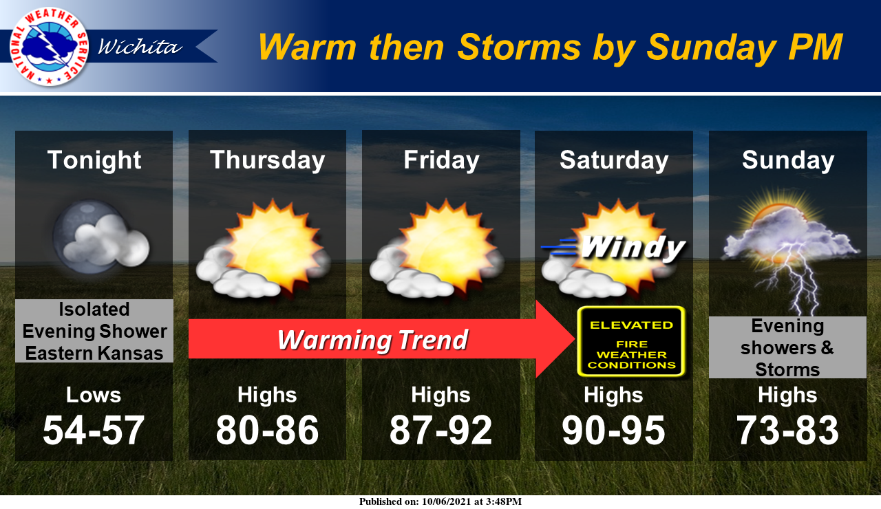
1- Another really nice cool morning will transition into a warmer than yesterday afternoon with winds increasing. Low humidity and strong winds will kick up the Fire Danger a little today but will really kick up Friday and Saturday with sustained winds of 20-30 mph. Be really careful out there with any fire related activity.
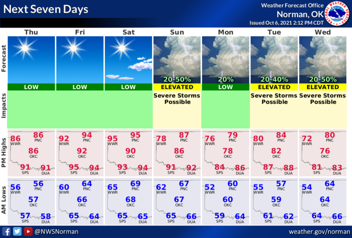
2-This weekend, rain chances go up especially on Sunday into Monday with a slight chance for possibly some severe weather. KEEP IN MIND that this system is several days out and the storm track is not well defined yet since all models are NOT in agreement. Several variables do exist on the Sunday and now the Tuesday/Wednesday storm systems too. No reason to get anxious about this right now. We’ll see how the models and forecasts verify as we get closer to these events.
3-Here is your forecast from the NWS/NORMAN;
Today-Mostly sunny. Highs in the upper 80s. South winds 10 to 15 mph with higher gusts.
Tonight-Mostly clear. Lows in the lower 60s. Southeast winds around 10 mph.
Be sure to download and update our GARFIELD COUNTY EM app. It just could save your life someday.
STAY SAFE!
MIKE