0400L-THURSDAY OUTLOOK FROM GARFIELD COUNTY EMERGENCY MANAGEMENT-10/8/2020
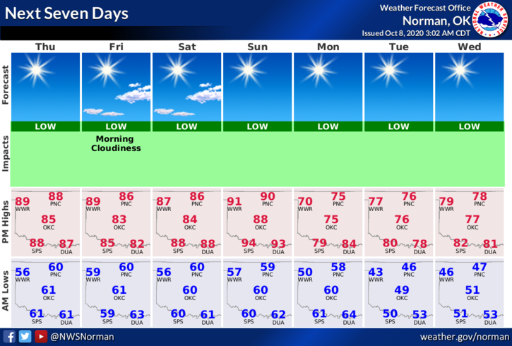
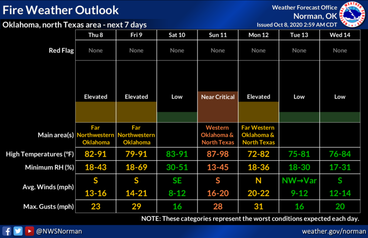
1- Warm and windy today as we continue under a high-pressure ridge. Highs will remain in the upper 80s to low 90s. We are expecting a front late Sunday that will bring temps back down to normal but per guidance, not much moisture to work with. This is increasing our Fire Danger so be careful with anything related to fire. We are in an abnormally dry area now so be careful.
2- After researching our long-range forecasts from several different companies, all are mostly in agreement that we will be in a La Nina weather pattern. Basically, we may see dryer than normal conditions which could cause drought related problems. Being under northwest flow for the most part, this may put us in an area where we could be more susceptible to ice events. This doesn’t mean we won’t see any major winter weather but it all depends on many factors in the atmosphere like where we are in between high and low pressure areas, moisture, winds, etc. Many factors are involved. It’s like any kind of severe weather, many elements must come together to make things happen so we’ll just have to wait and see.
3- For now, enjoy the heat while you can as this winter could be interesting depending on what mother nature decides to throw at us. Here is your forecast from the NWS/NORMAN;
Today- Sunny. Highs in the upper 80s. South winds 10 to 15 mph with higher gusts.
Tonight-Clear. Lows in the upper 50s. South winds 10 to 15 mph with higher gusts.
4- Finally, be sure and get our GARFIELD COUNTY EM app. You’re NOT PREPARED without it!!
HAVE A GOOD DAY
MIKE