0403L-THURSDAY OUTLOOK & INFO FROM GARFIELD COUNTY EMERGENCY MANAGEMENT-9/12/19
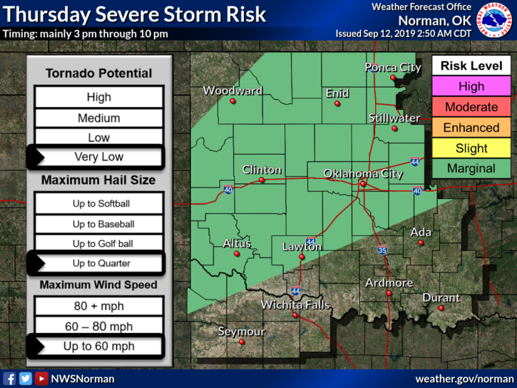
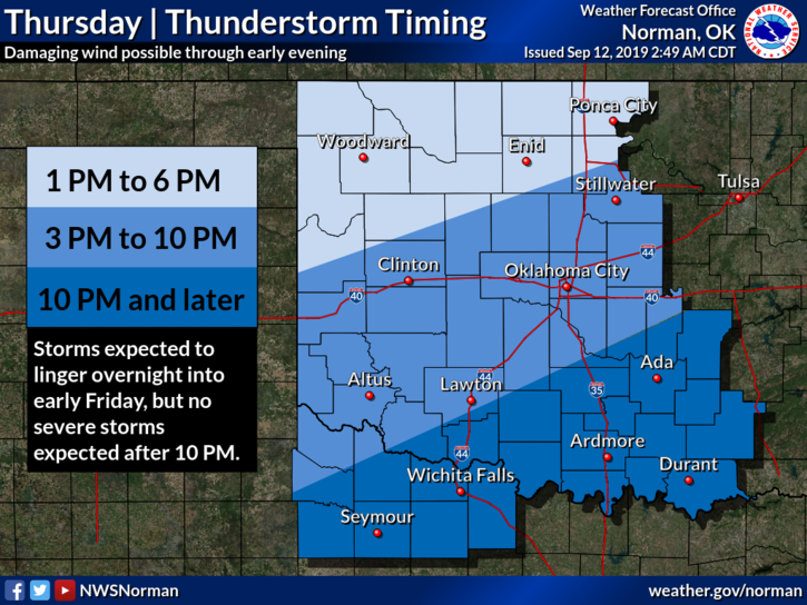
1- MARGINAL RISK for severe weather. Hail and winds will be the main threats. Per NWS GUIDANCE, frontal passage may occur around mid-day. I will send out more info through our GARFIELD COUNTY EM app around mid-morning.
2- Preparing an emergency kit. Details on all sorts of kits can be obtained from the FEMA, GCEM, and RED CROSS websites. There are many others too. Here is a key factor and I have stated this many times in the past; what does it take to get you through each day? Take that answer times 7 and you are good to go for you. Do this for each person in your family. You should now be able to survive for a week. Your kits should have the balance of your needs in them. It’s different for everyone so take the time to study this and apply what you learn and you should be ok. Without typing a book that most won’t read, it doesn’t get any simpler than this. Good luck with this task, you can do this.
3- Here is your forecast from the NWS/NORMAN;
Today-Showers and thunderstorms, mainly after 1pm. High near 88. South wind 10 to 14 mph, with gusts as high as 20 mph. Chance of precipitation is 90%. New rainfall amounts between three quarters and one inch possible.
Tonight-Showers and thunderstorms likely, mainly before 10pm. Mostly cloudy, with a low around 65. North wind around 6 mph becoming calm in the evening. Chance of precipitation is 70%. New rainfall amounts between a tenth and quarter of an inch, except higher amounts possible in thunderstorms.
HAVE A GOOD DAY!!
MIKE