0420L-THURSDAY UPDATE FROM ENID/GARFIELD COUNTY EMERGENCY MANAGEMENT-9/20/18
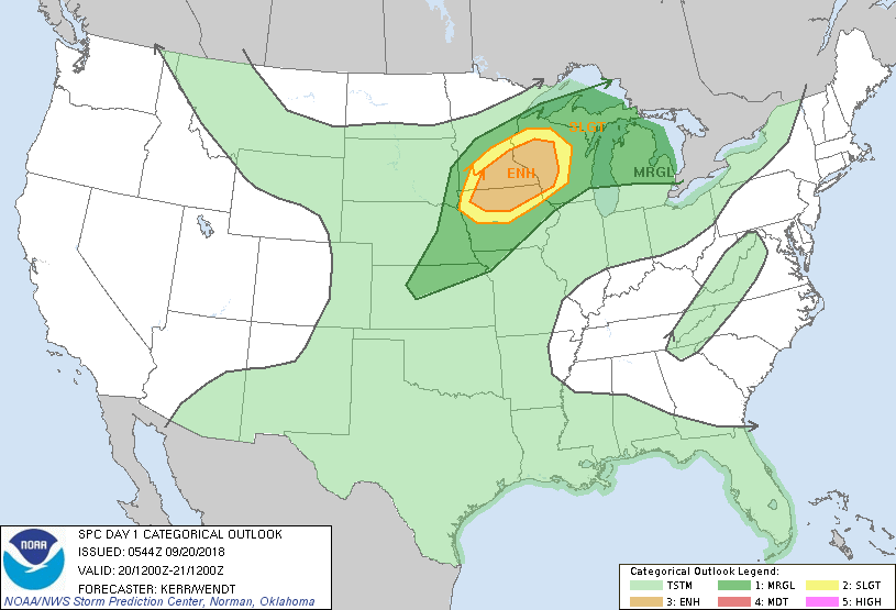
WE ARE IN A “GENERAL THUNDERSTORM RISK AREA.” There may be a few thunderstorms later tonight but the severe threat is low.
1-RAIN will be the main issue over the next several days starting tonight. Many Friday night football games have been changed to tonight because of the rainfall potential on Friday. Here in northern Oklahoma, we can expect roughly an inch to inch and a half. See graphic below. This graphic will change some so don’t get hung up on where the lines are. They WILL change.
2-Per guidance, an AREAL FLOOD WATCH has just been issued for the southern 2/3rds of the state so if you plan to travel or if you live in the southern 2/3rds of the state, PAY ATTENTION for possible flood issues. We are not in this watch at this time. If you live in a flood prone area, pay close attention to conditions.
3- If you like to read, here is one discussion of many I read every morning. Here is the link- https://forecast.weather.gov/product.php?site=NWS&issuedby=OUN&product=AFD
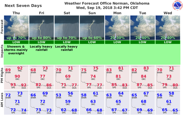
4- Here is your forecast for Garfield County from the NWS/NORMAN;
Today-Mostly sunny. Highs in the lower 90s. South winds 10 to 20 mph.
Tonight-Partly cloudy. A chance of thunderstorms in the evening, then showers likely and a chance of thunderstorms after midnight. Lows around 70. Southeast winds 10 to 15 mph. Chance of precipitation 60 percent.
If there are any changes, I will do a few live broadcasts as needed.
HAVE A SUPER DAY!!
MIKE