0410L-FRIDAY UPDATE FROM ENID/GARFIELD COUNTY EMERGENCY MANAGEMENT-9/21/18
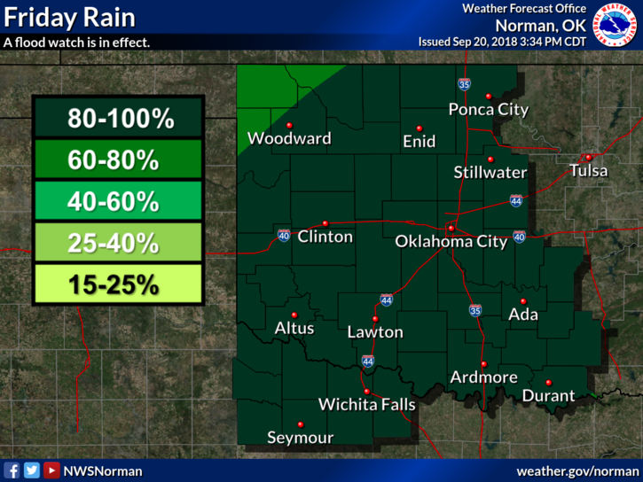
1- The front is taking its dear sweet time getting here but it should arrive sometime this morning. Rainfall is expected but we may not see as much that was forecast for us yesterday. That said, we will see rainfall and the heavier amounts are still expected in the southern 2/3rds of the state.
2- If you plan on traveling, stay aware of conditions along your route and your destinations.
3- Overnight lows starting tonight will be quite a bit cooler so fall is in the air but watch out for summer, it might try to sneak back in.
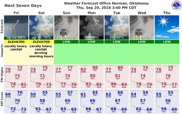
4- Here is your forecast from the NWS/NORMAN;
Friday-Showers and possibly a thunderstorm, mainly before 1pm, then rain likely after 1pm. Some of the storms could produce heavy rainfall. High near 71. North northeast wind 5 to 10 mph increasing to 10 to 20 mph in the afternoon. Winds could gust as high as 25 mph. Chance of precipitation is 90%. New rainfall amounts between a half and three quarters of an inch possible.
Friday Night-20 percent chance of rain before 1am. Mostly cloudy, then gradually becoming mostly clear, with a low around 54. North northeast wind 10 to 15 mph.
Have a great day!!
MIKE