0415L-THURSDAY OUTLOOK FROM GARFIELD COUNTY EMERGENCY MANAGEMENT-9/30/21
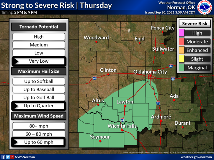
1- The front is coming and it appears rain is coming with it. Probabilities for rainfall are high later this morning but the severe threat remains south and southeast for today. Rain could be heavy at times since the front is moving slowly so keep this in mind if you are out and about. Localized flooding is also possible in those areas where the heavier rainfall occurs. Just be careful.
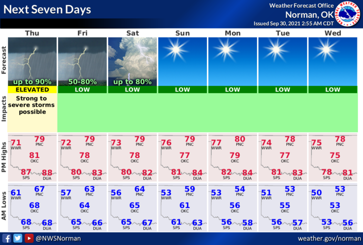
2- Overall, the rain is much needed so we’ll see how all of this mess comes together and hopefully we see 1-2 inches of rainfall by the end of the weekend. Here is your forecast from the NWS/NORMAN;
Today-Not as warm. Thunderstorms in the morning, then thunderstorms likely in the afternoon. Highs in the upper 70s. East winds 10 to 20 mph.
Tonight-Mostly cloudy with a chance of thunderstorms. Lows around 60. North winds around 10 mph in the evening becoming light and variable. Chance of thunderstorms 50 percent.
FINALLY, be sure and get our GARFIELD COUNTY EM app. You never know, it just might save your life.
STAY SAFE
MIKE