0425L-THURSDAY UPDATE FROM ENID/GARFIELD COUNTY EMERGENCY MANAGEMENT-9/6/18
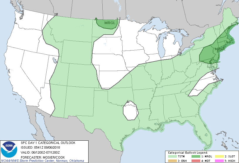
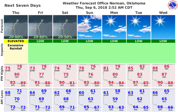
1-RAIN CHANCES will continue through Saturday as it looks. Next week looks pretty nice. Also, it doesn’t appear we, Garfield County, will see a major impact from the remnants of Gordon. That energy looks to hit mainly the Louisiana/Arkansas areas then move on to the northeast. We’ll still see rain as we are still in a tropical atmosphere.
2-Yesterday there were pics and reports of “funnels”. No one reported these directly to me. These funnels aren’t normally a major risk BUT I need to be aware they are happening when they do occur. In a tropical atmosphere with low cloud bases, it’s more likely to have” funnels” form near outflow boundaries where “convection” is occurring. These can occur anytime when conditions are just right. AGAIN, they were FUNNELS, not rope tornadoes or any tornado.
TORNADO– a rapidly rotating column of air “IN CONTACT” with the ground
FUNNEL– a rapidly rotating column of air NOT IN CONTACT with the ground
PLEASE report these to me when seen and then tell the world what you are seeing. Don’t use social media to contact me. Email me or call me directly. Pictures and video are always good.
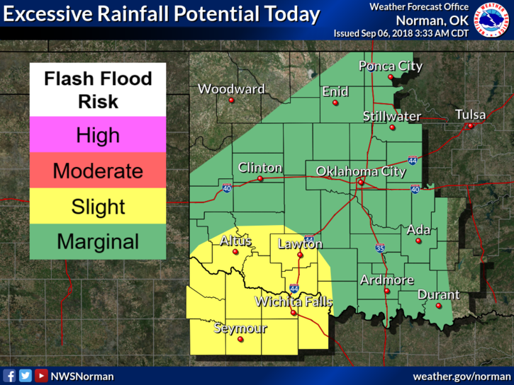
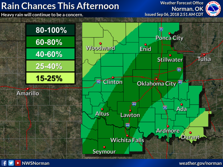
3- Here is your forecast from the NWS/NORMAN;
Today-Mostly cloudy. A chance of showers and isolated thunderstorms in the morning, then showers likely and isolated thunderstorms in the afternoon. Some thunderstorms may produce heavy rainfall. Highs in the upper 70s. Northeast winds around 10 mph. Chance of precipitation 60 percent.
Tonight-Mostly cloudy. A chance of showers and isolated thunderstorms. Some thunderstorms may produce heavy rainfall in the evening. Lows in the upper 60s. North winds around 10 mph. Chance of precipitation 40 percent.
HAVE A GOOD DAY!!
MIKE