0345L-TUESDAY OUTLOOK FROM GARFIELD COUNTY EMERGENCY MANAGEMENT-4/20/21
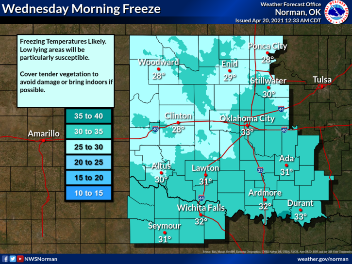
1- FREEZE WARNING in effect from 1 am until 9 am WEDNESDAY morning. Temps as low as 28 degrees are possible. You all should know what to do. Cover up newly planted items and make sure your hoses are DIS-connected from the house.
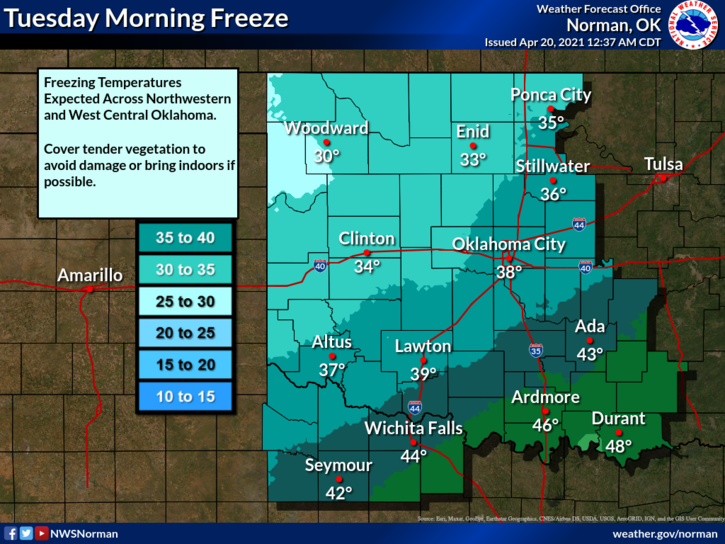
2- There is a slight chance of temps reaching 32 this morning but we may just miss that mark. The winds will be the issue today as we expect some gusts upwards of 30 mph. The fire danger is low but we are very dry out there so keep that eye out and report any smoke or fire that you may see to 911. NO CONTROLLED BURNING TODAY, PLEASE.
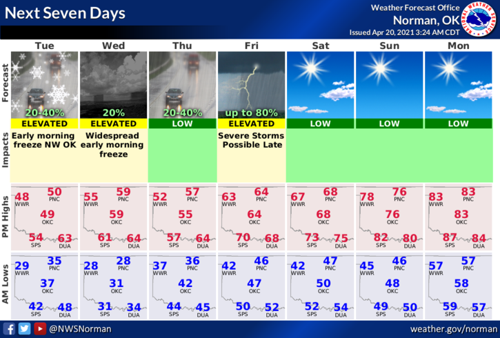
3- Overall, we’ll be ok so here is your forecast from the NWS/NORMAN;
Today-Cloudy with a slight chance of rain showers late in the morning. Partly cloudy in the afternoon. Much cooler. Highs in the lower 50s. North winds 15 to 25 mph with higher gusts. Chance of showers 20 percent.
Tonight-Clear. Widespread frost after midnight. Lows in the upper 20s. Northeast winds 10 to 15 mph in the evening becoming light and variable late.
FINALLY, be sure and get our GARFIELD COUNTY EM app. It’s loaded with very important information that is extremely useful in your preparedness process and it just might SAVE YOUR LIFE.
HAVE A GOOD DAY!
MIKE