0415L-MONDAY OUTLOOK FROM GARFIELD COUNTY EMERGENCY MANAGEMENT-4/19/21
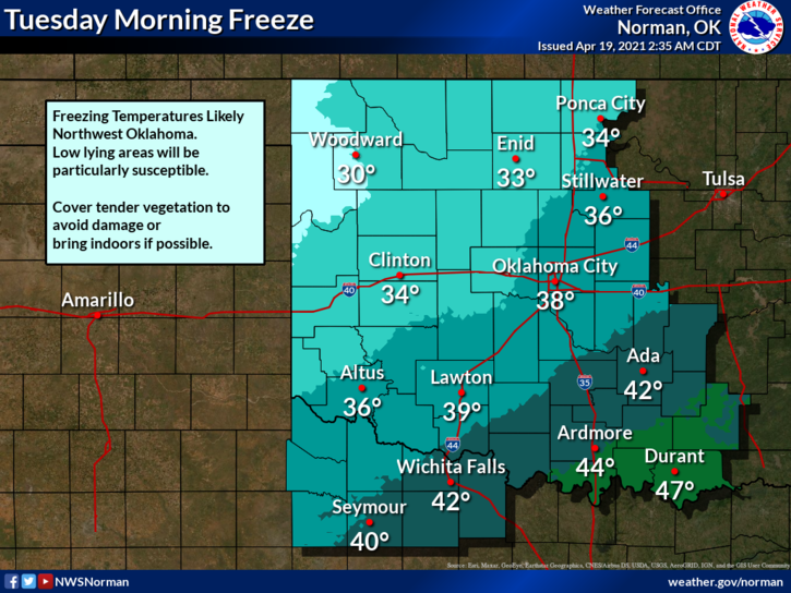
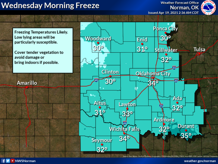
1- As of right now, we are in a FREEZE WATCH from late Tuesday night through Wednesday morning. A freeze warning is in effect for counties to our west and southwest. It wouldn’t surprise me if we are added to the warning sometime in the near future. See graphics attached for the broad view.
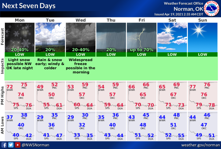
2-A cold front will push its way through the state overnight tonight so you will notice a dramatic fall in temperatures as highs today will be in the low 70s and Tuesday’s high will be in the upper 40s. We will struggle to get back up into the 70s by next Sunday. There is also an extremely low chance for some light winter precipitation as rain and a snow mix are possible. No travel issues are expected. The WIND CHILL will become a factor so make sure you send the kids to school with a coat! Where did I put my coat?
3- We will conduct another VOICE SIREN TEST TODAY AT NOON IN ENID. Don’t freak out, it’s only me. We will fire the whole system on the first Monday of each month. More details on our voice capability will be forthcoming.
4- Here is your forecast from the NWS/NORMAN;
Tonight-30 percent chance of rain after 1am. Increasing clouds, with a low around 33. East northeast wind 5 to 15 mph becoming north northeast 15 to 25 mph in the evening. Winds could gust as high as 30 mph.
Tuesday-Cloudy, then gradually becoming mostly sunny, with a high near 51. North wind 15 to 25 mph, with gusts as high as 31 mph.
FINALLY, download our GARFIELD COUNTY EM app. Besides being able to receive information from us and the NWS, the information you get within the app just might SAVE YOUR LIFE!
HAVE A GOOD DAY!
MIKE