FROM GARFIELD COUNTY EMERGENCY MANAGEMENT
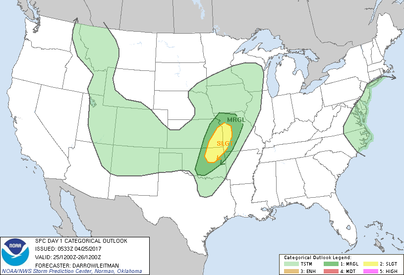
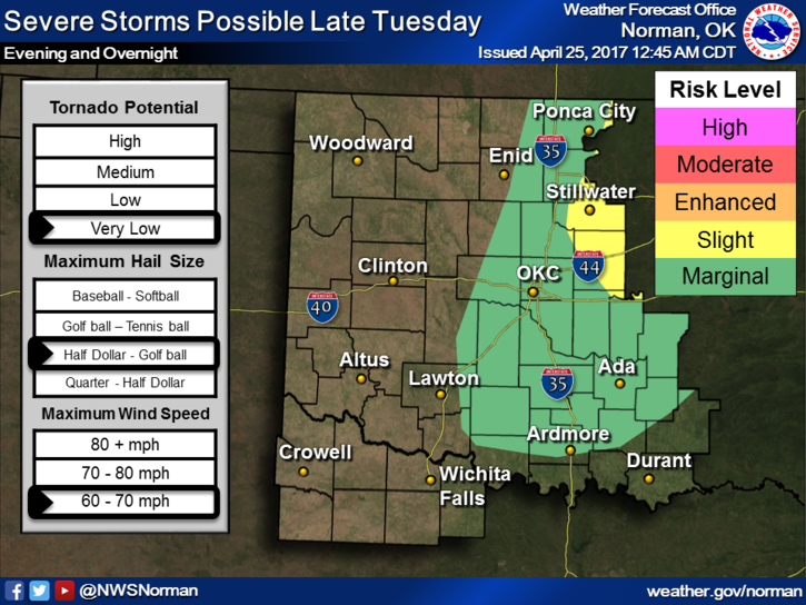
We are on the edge of a MARGINAL risk for severe weather later this evening and possibly overnight. “If” we do see development we can expect gusty winds, hail, and heavy rainfall. Basically the normal low threats.
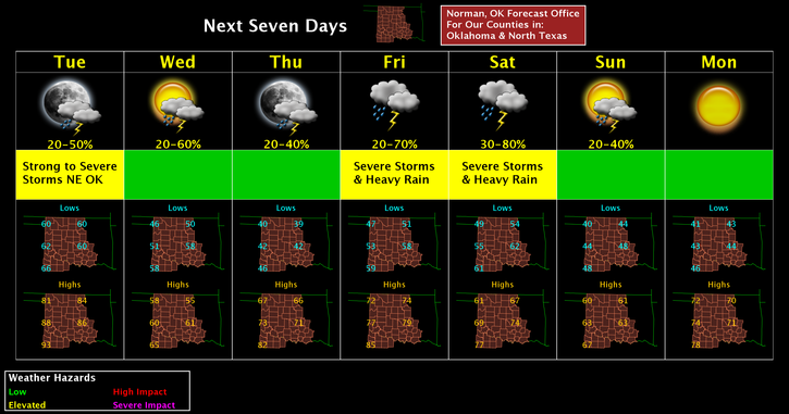
A cold front will push through and we’ll be a bit cooler for Wednesday and then our next possible weather threat will be Friday into Saturday. A lot still remains to be seen this far out so be prepared, read the discussions and outlooks carefully before looking at a picture and going into the panic mode.
Here is your forecast from the NWS/NORMAN;
Tuesday-Mostly sunny, with a high near 83. South wind 14 to 16 mph, with gusts as high as 23 mph.
Tuesday Night-40 percent chance of showers and thunderstorms, mainly before 1am. Mostly cloudy, with a low around 49. West northwest wind 8 to 16 mph becoming north in the evening. Winds could gust as high as 23 mph.
HAVE A GREAT DAY!!
MIKE