FROM GARFIELD COUNTY EMERGENCY MANAGEMENT
There is a chance for a few thunderstorms this morning as an upper level trough moves through. We don’t expect this line to be severe so if the cells within this trough can maintain themselves, expect possibly heavy rainfall, a little lightning and thunder, and gusty winds.
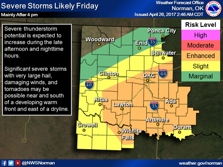
That said, there are still many variables concerning Friday’s weather. I am not going to comment much on this yet because where things set up are still not set in stone. I will say this; it appears we may see quite a bit of rain. Again, not sure on totals yet. Timing, moisture return, and actual frontal locations, and several other factors are not set in stone.
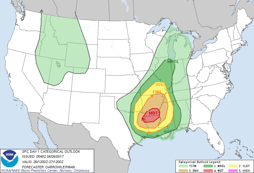
It does appear as you can see in the graphic that being in Southeastern Oklahoma into Central Arkansas may not be a good idea on Friday. EXTREME CAUTION IS ADVISED if you plan to travel in that direction. We’ll watch this carefully and we’ll see how the forecast verifies.
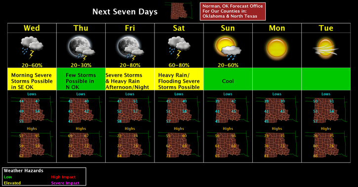
Here is your forecast from the NWS/NORMAN.
Wednesday-30 percent chance of showers before 1pm. Mostly cloudy, with a high near 57. North wind 15 to 20 mph, with gusts as high as 28 mph.
Wednesday Night-Mostly cloudy, then gradually becoming clear, with a low around 40. Northwest wind 6 to 11 mph becoming light and variable.
HAVE A GREAT DAY!!
MIKE