0350L-TUESDAY OUTLOOK & INFO FROM GARFIELD COUNTY EMERGENCY MANAGEMENT-4/28/2020
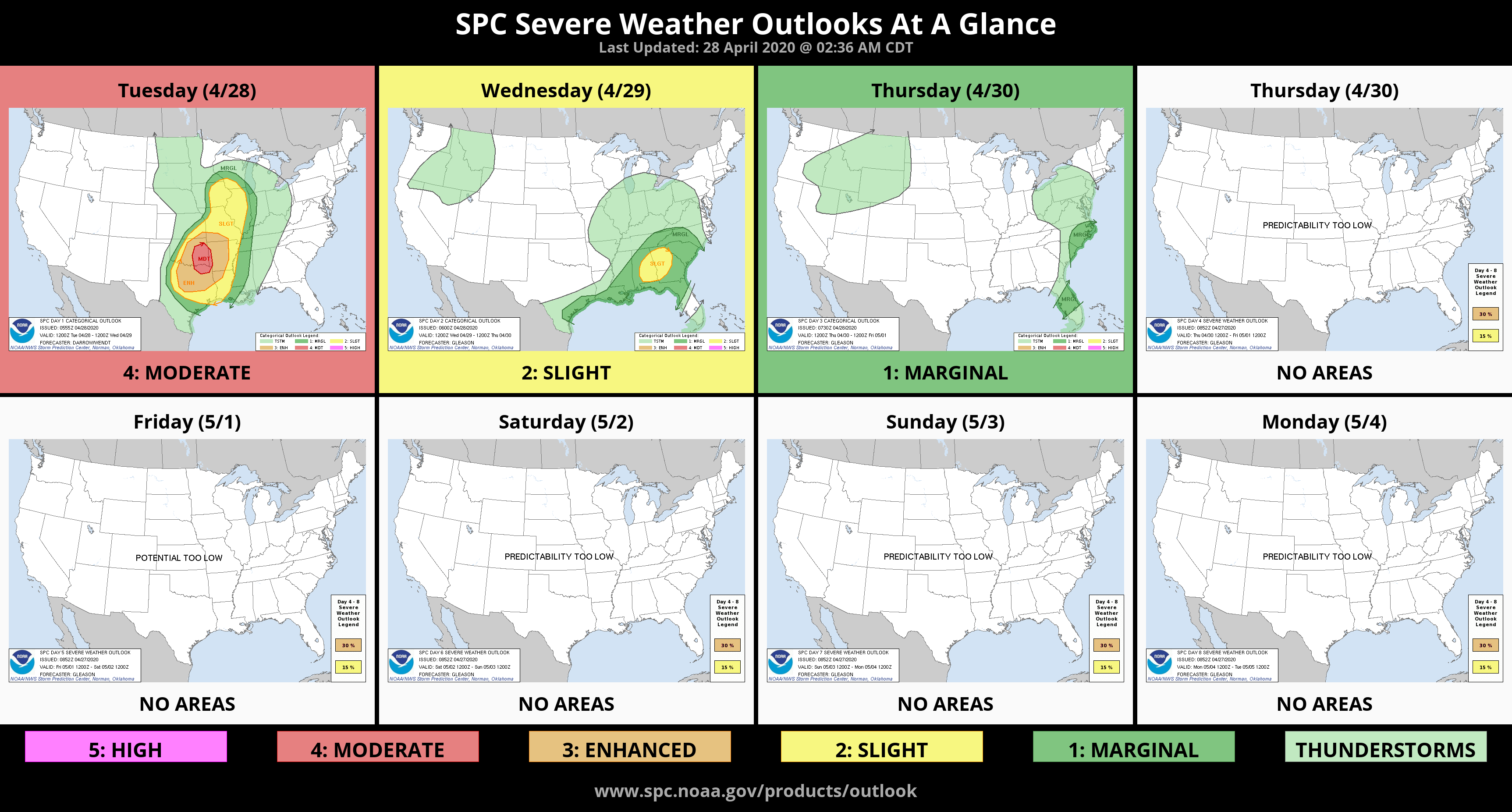
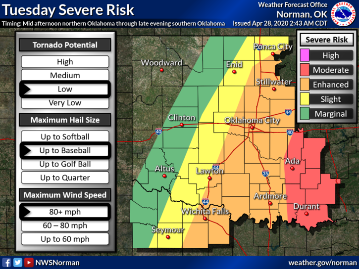
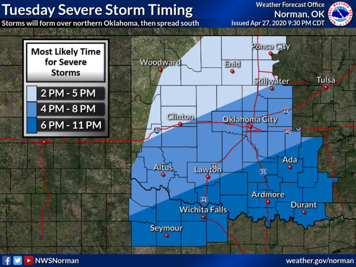
1-*WE ARE IN A SLIGHT & ENHANCED RISK FOR SEVERE WEATHER TODAY. AS IT APPEARS, OUR GREATEST RISK WILL BE HAIL AND WINDS. THIS WILL DEPEND ON WHERE THE FRONT IS AND LOCAL CONDITIONS AS IT PUSHES THROUGH THIS AFTERNOON. We’ll advise on this as updates are provided and forward info to you over our GARFIELD COUNTY EM app and over social media. Graphics provided will change a few times today.*
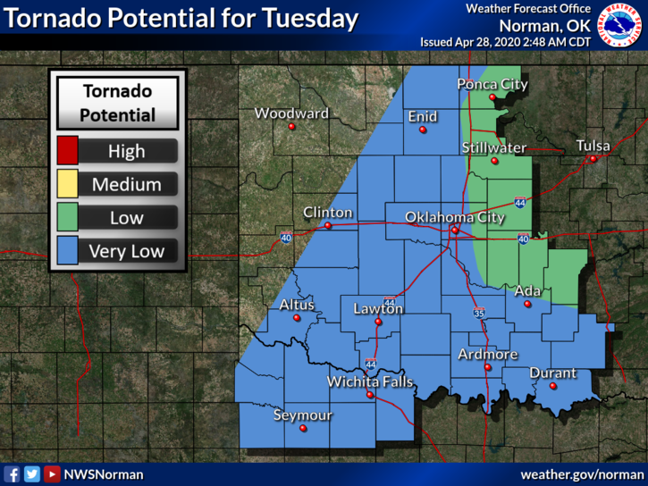
2- Garfield County Spotters will be advised on possible activation information around mid-morning. The TORNADO THREAT FOR US IS VERY LOW. If anyone plans on traveling today, stay away from eastern and southeastern Oklahoma, SW Arkansas, and NE Texas. It may get a bit tense later today and tonight.
3- Overall, we should be ok but will advise accordingly as the day progresses. Here is your forecast from the NWS/NORMAN;
Tuesday-30 percent chance of showers and thunderstorms, mainly after 1pm. Some storms could be severe. Increasing clouds with a high near 83. South wind 10 to 15 mph becoming north northwest in the afternoon. Winds could gust as high as 20 mph.
Tuesday Night-Mostly clear with a low around 51. North wind 10 to 15 mph, with gusts as high as 20 mph.
HAVE A GOOD DAY!!
MIKE