FROM GARFIELD COUNTY EMERGENCY MANAGEMENT-TUESDAY 8/15/2017
Download our emergency app-GARFIELD COUNTY EM. It just might save your life.
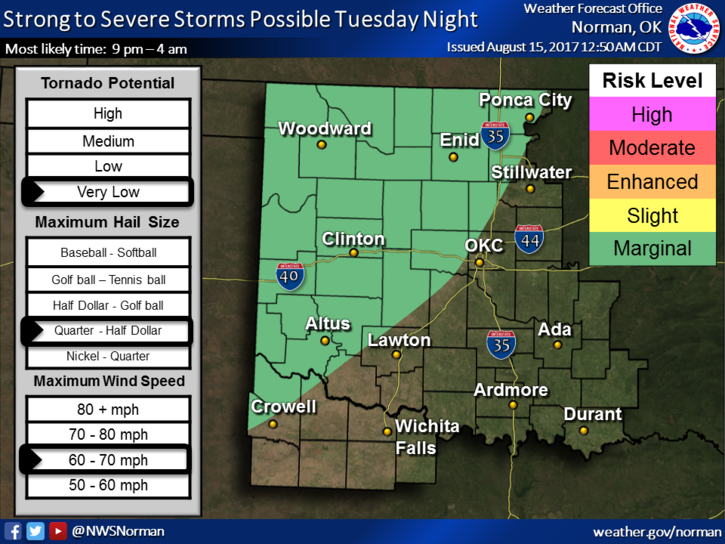
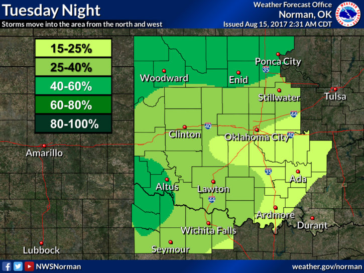
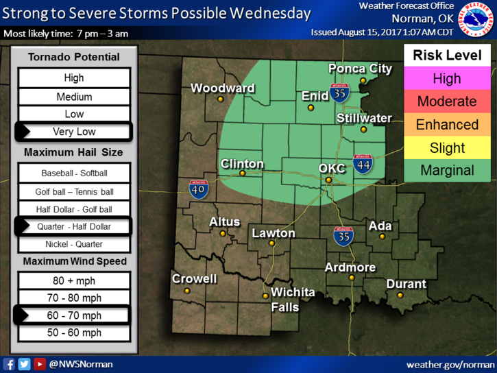
Key words for today- HOT AND HUMID. It’s coming back!!! That said, showers and thunderstorms will be back on hand to make some noise later today and tonight as a trough works its way through the area. Storms will be more distinct tonight and overnight.
If severe storms occur, and its possible, winds hail and heavy rainfall will be the threats.
REMEMBER, we are still saturated from rainfall last week so be EXTREMELY careful if driving in low lying areas. Remember the barricades? Don’t go around them!!
Read the graphs attached carefully and keep in mind that any boundary on these will be subject to movement meaning they will move around as the forecast verifies and changes. For instance, you can’t base Tuesday evenings storm forecast from this morning’s information. IT WILL CHANGE during the day. Keep up with the latest information from the NWS/NORMAN and us, of course.
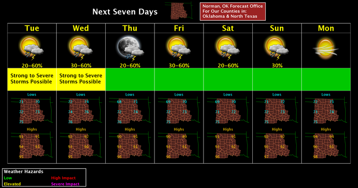
We’ll keep an eye out today and will update as needed. Here is your forecast from the NWS/NORMAN;
Tuesday-Mostly sunny, with a high near 90. Southeast wind 5 to 10 mph.
Tuesday Night-40 percent chance of showers and thunderstorms. Mostly cloudy, with a low around 74. South winds around 10 mph.
HAVE A GREAT DAY and STAY SAFE
MIKE