0410L-TUESDAY UPDATE FROM ENID/GARFIELD COUNTY EMERGENCY MANAGEMENT-8/28/18
Don’t forget to download our app. You’re NOT prepared without it. GARFIELD COUNTY EM
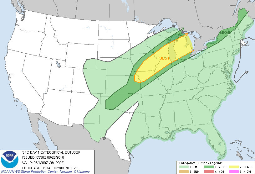
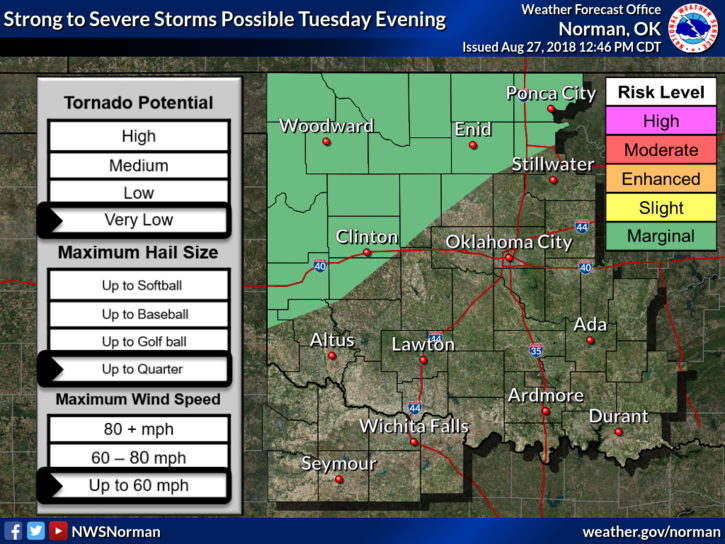
1-We are in a MARGINAL RISK for strong to severe weather later today. Timing- early to the middle evening hours. The front isn’t moving at a set pace so this MAY be an issue.
2- IF STORMS OCCUR, the main risks will be torrential rainfall, strong winds, intense lightning, and quarter size hail.
3-Overall, we’ll be ok so just prepare for the possibility of some heavy weather this evening. Other than this, EXPECT STRONG WINDS AND HOT TEMPS. A day of relief comes on Wednesday.
4- Here is your forecast from the NWS/NORMAN;
Today-Mostly sunny. Isolated thunderstorms early in the morning. A slight chance of thunderstorms late in the afternoon. Highs in the mid 90s. South winds 15 to 20 mph. Chance of thunderstorms 20 percent.
Tonight-Mostly cloudy with a chance of thunderstorms. Lows in the upper 60s. South winds 10 to 15 mph shifting to the north after midnight. Chance of thunderstorms 40 percent.
HAVE A GREAT DAY!!
MIKE