0410L-WEDNESDAY UPDATE FROM ENID/GARFIELD COUNTY EMERGENCY MANAGEMENT-8/29/18
DOWNLOAD OUR “GARFIELD COUNTY EM”APP. You’re not prepared without it.
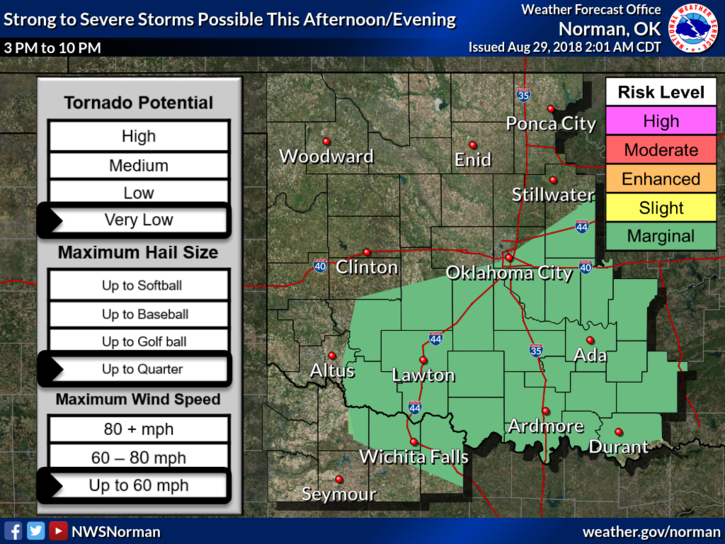
1- We are in a GENERAL RISK for thunderstorms today. We missed them overnight but MIGHT see some this morning. You’ll notice winds out of the north and temps today will be in the 80’s. IF storms make it here, expect heavy rainfall, lightning & thunder, and gusty winds. We don’t expect severe weather but as always, it could occur due to winds and possibly hail.
2-Thunderstorms have trained over the same areas out west so if you plan to travel, check your forecast in the area you are traveling, otherwise, install pontoons on your vehicle and enjoy the float trip!! Remember-TURN AROUND, DON’T DROWN.
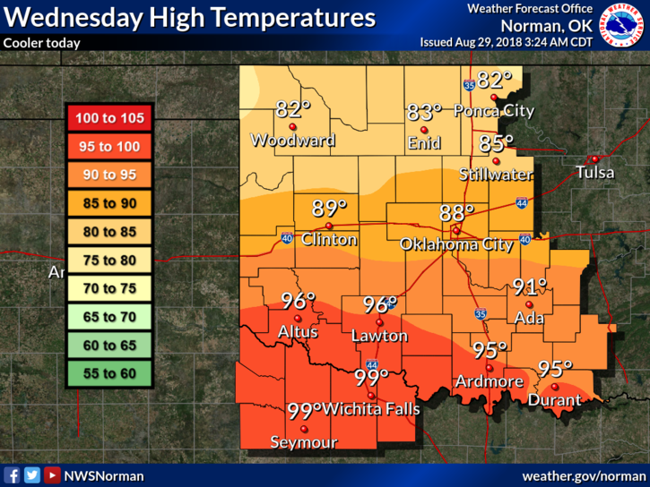
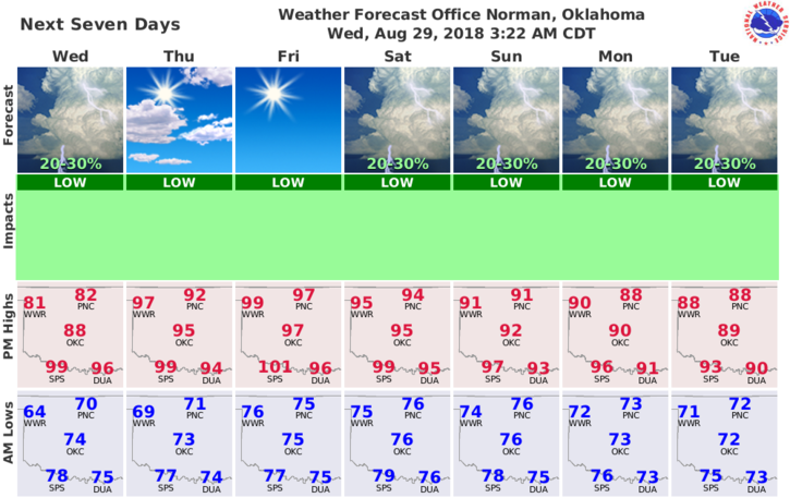
3- Here is your forecast from the NWS/NORMAN;
Today-Mostly cloudy with a chance of thunderstorms in the morning, then partly cloudy in the afternoon. Not as warm. Highs in the mid 80s. Northeast winds around 10 mph in the morning becoming light and variable. Chance of thunderstorms 30 percent.
Tonight-Partly cloudy. A slight chance of thunderstorms in the evening. Lows in the lower 70s. East winds around 10 mph in the evening becoming light and variable. Chance of thunderstorms 20 percent.
HAVE A GREAT DAY!
MIKE