0350L-TUESDAY OUTLOOK & INFO FROM GARFIELD COUNTY EMERGENCY MGMT-8/4/2020
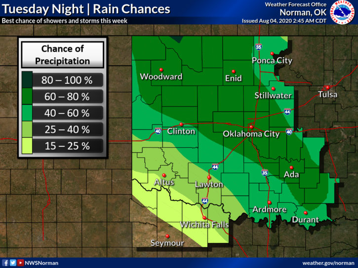
1- MARGINAL RISK for severe weather mainly tonight. Part of the county is Marginal and the other General so we’ll see how the storms track later and what their main impacts will be. If any storm does go severe, it will be due to winds and hail. Just be prepared either way.
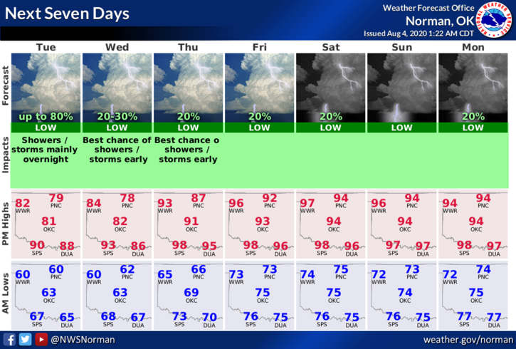
2- Showers and storms may occur this morning too but they are not expected to be severe. If you plan on traveling West or NW, You’ll see some rain. Temperature-wise, we’ll be back in the 90’s by the weekend so get ready for the humidity to increase.
3- Mosquitoes are on the loose again so make sure you take protective measures against them. West Nile Virus is still prevalent around here so use caution while outdoors especially around wooded and creek areas. Also, watch out for ticks while in those areas. They are really thick right now too. Tick fever is no fun either.
4- Overall, we’ll be ok. Here is your forecast from the NWS/NORMAN;
Tuesday-Partly cloudy. A chance of thunderstorms in the morning, then a slight chance of thunderstorms in the afternoon. Highs around 80. East winds around 10 mph. Chance of thunderstorms 40 percent.
Tuesday Night-Partly cloudy. Thunderstorms likely after midnight. Lows around 60. East winds around 10 mph. Chance of thunderstorms 70 percent.
HAVE A GOOD DAY!!
MIKE