0405L-TUESDAY UPDATE FROM ENID/GARFIELD COUNTY EMERGENCY MANAGEMENT-8/7/18
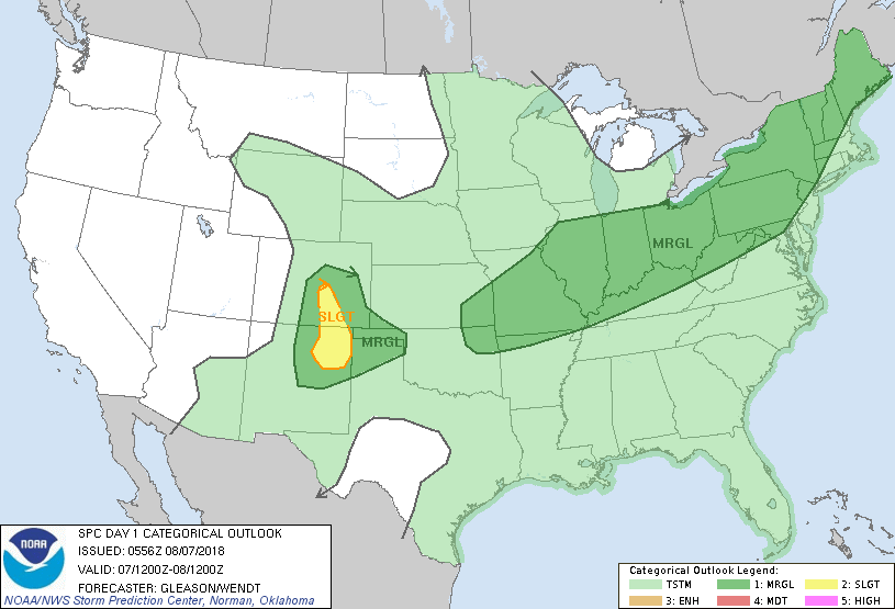
1-A surface boundary is expected to push into the area this afternoon. It should stall out somewhere in the region thus becoming a focal point for additional thunderstorm activity for tonight into tomorrow. This said, widespread activity is possible with wind and hail being the main threats along with the potential for localized flooding especially in urban and low lying areas.
2-Another boundary will affect the area Wednesday into Thursday. We’ll see what happens!!
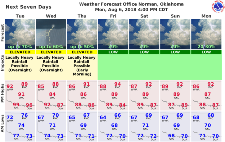
3- Here is your forecast for Tuesday;
Tuesday-Partly cloudy. 30% chance of thunderstorms. Highs in the lower 90s. Southwest winds around 10 mph shifting to the northwest in the afternoon.
Tuesday Night-Partly cloudy with lows in the lower 70s. East winds around 10 mph in the evening becoming light and variable. Chance of thunderstorms 50 percent this evening and overnight.
HAVE A GOOD DAY!!
MIKE