0428L-WEDNESDAY UPDATE FROM ENID/GARFIELD COUNTY EMERGENCY MANAGEMENT-8/8/18
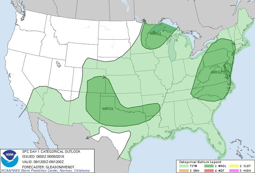
1-We are in a GENERAL RISK for severe weather today. WINDS will be the main issue beside the potential for flooding. A shortwave trough is moving west to east this morning so everything happening out to our west and northwest will hopefully move our way a little later this morning. WE NEED THE RAIN.
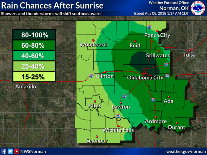
2- FLOOD WATCH IN EFFECT UNTIL NOON. AS OF 0415 THIS MORNING NO RAIN HAS OCCURRED EXCEPT IN THE SW QUADRANT OF THE COUNTY. The rain will hopefully come through the whole area by Thursday morning.
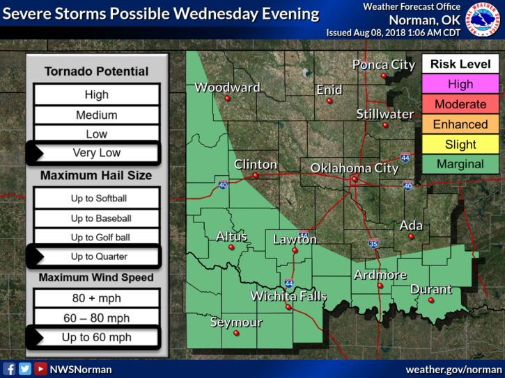
3- As I type, there is a SEVERE THUNDERSTORM WARNING FOR THE SW QUADRANT OF THE COUNTY, DUE TO POSSIBLE WINDS OF 60+ MPH. The lightning show has definitely been impressive this morning.
4- Here is your forecast from the NWS/NORMAN;
Today-Mostly cloudy with thunderstorms likely early in the morning, then partly cloudy with a slight chance of thunderstorms in the late morning and afternoon. Highs in the mid 80s. East winds around 10 mph. Chance of thunderstorms 70 percent.
Tonight-Partly cloudy with a slight chance of thunderstorms. Lows in the upper 60s. Southeast winds around 10 mph in the evening becoming light and variable. Chance of thunderstorms 20 percent.
I’ll advise as needed.
MIKE