0340L-TUESDAY OUTLOOK FROM GARFIELD COUNTY EMERGENCY MANAGEMENT-12/14/21
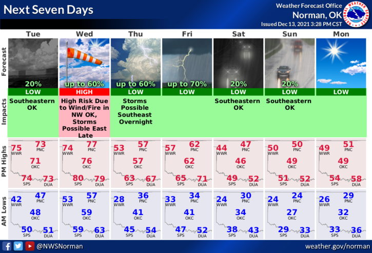
1- WARM AND WINDY TODAY AND YOU NEED TO GET PREPARED FOR WEDNESDAY’S WIND EVENT. For today, winds will average 10-20 mph with the highest wind gusts occurring around mid-afternoon when gusts could reach 30 mph. Here is your forecast from the NWS/NORMAN;
Today-Decreasing clouds. Highs in the lower 70s. South winds 10 to 20 mph gusting to 28 mph.
Tonight-Partly cloudy. Warmer. Lows in the upper 50s. South winds 15 to 20 mph gusting to 28 mph.
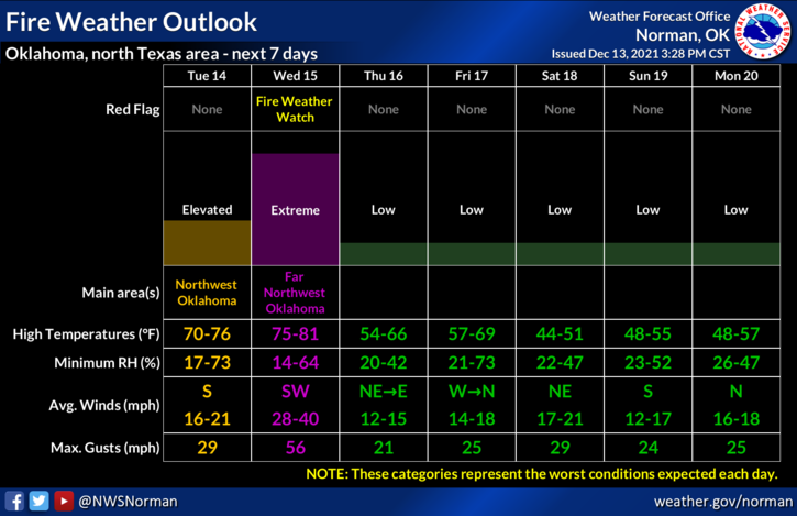
2- There is trough that will push across the area tomorrow bringing with it a cold front. After dangerously highs winds on Wednesday, a front will push in sometime around the 6 to 9pm timeframe shifting the wind from the south to the north at 10-20 mph. Just be prepared for blowing dust and debris throughout the day on Wednesday and a little bit today. Some gusts on Wednesday could exceed severe levels especially out west. Travel on east/west roads may prove challenging. USE EXTREME CAUTION.
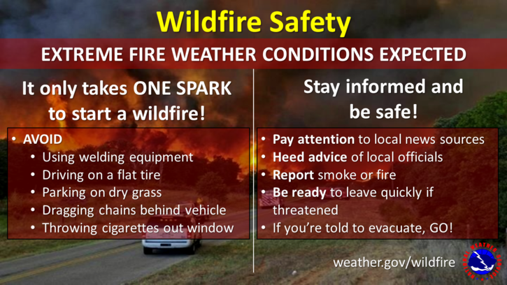
3- The FIRE DANGER remains elevated for today but will be in the extreme category tomorrow around the area. If you see smoke and fire, call 911 immediately so a quick response can be dispatched.
4- Since hacking has become an issue on social media, our posts for emergency management will only be sent to the GCEM website at www.gcem.org and the GARFIELD COUNTY EM app under GCEM BLOG until after the first of the year. I will advise if we decide to get back on social media.
HAVE A GOOD DAY!