0408L-TUESDAY OUTLOOK FROM GARFIELD COUNTY EMERGENCY MANAGEMENT-12/22/2020
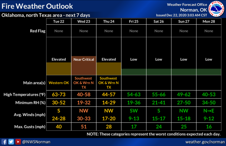
1- A cold front is pushing towards our area thus the wind gradient will increase. As it does, winds will become a nuisance and cause the fire danger to increase. Wind gusts today could reach 40 mph or higher. The good part of the day will be mid 60s temperatures. If you can find a place out of the wind but facing the sun, enjoy the day!
2- Winds will possibly increase tonight as the front pushes in sometime after midnight. Winds will shift and be gusty and then when the sun comes up, winds will increase dramatically. CONTROLLED BURNING IS HIGHLY ILL-ADVISED. If you see smoke or fire, call 911 so the proper response can be sent. WEDNESDAY, winds will be a little stronger than today so secure anything that could take flight both at home and at work and hopefully nothing is lost.
3- If you happen to see any powerlines arcing and sparking, call OGE IMMEDIATELY- 800-522-6870. You can access their website from our gcem.org site.
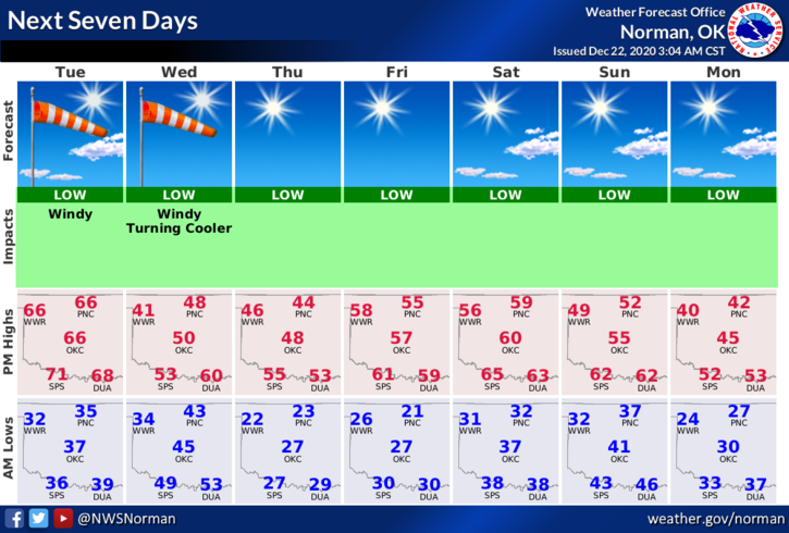
4- OVERALL, WE’LL BE OK BUT TAKE PRECAUTIONS FROM THE HIGH WINDS. Here is your forecast from the NWS/NORMAN;
Tuesday-Sunny, with a high near 64. Windy, with a south southeast wind 10 to 15 mph increasing to 20 to 25 mph in the afternoon. Winds could gust as high as 36 mph.
Tuesday Night-Partly cloudy, with a low around 40. South wind 20 to 25 mph becoming west northwest after midnight. Winds could gust as high as 40 mph.
5- Download our GARFIELD COUNTY EM app. You’re NOT PREPARED without it.
HAVE A GOOD DAY!
MIKE